You are here: Home > Network List > UU - University of Utah Regional Network Stations List
> Station KNB Kanab, UT, USA > Earthquake Result Viewer
KNB Kanab, UT, USA - Earthquake Result Viewer
*The percent match for this event was below the threshold and hence no stack was calculated.
| Earthquake location: |
Solomon Islands |
| Earthquake latitude/longitude: |
-4.8/154.8 |
| Earthquake time(UTC): |
2015/03/20 (079) 15:42:52 GMT |
| Earthquake Depth: |
26 km |
| Earthquake Magnitude: |
5.5 MWB |
| Earthquake Catalog/Contributor: |
NEIC PDE/NEIC COMCAT |
|
| Network: |
UU University of Utah Regional Network |
| Station: |
KNB Kanab, UT, USA |
| Lat/Lon: |
37.02 N/112.82 W |
| Elevation: |
1715 m |
|
| Distance: |
94.7 deg |
| Az: |
53.364 deg |
| Baz: |
267.599 deg |
| Ray Param: |
$rayparam |
*The percent match for this event was below the threshold and hence was not used in the summary stack. |
|
| Radial Match: |
53.34141 % |
| Radial Bump: |
400 |
| Transverse Match: |
67.87715 % |
| Transverse Bump: |
400 |
| SOD ConfigId: |
7422571 |
| Insert Time: |
2019-04-17 20:30:05.058 +0000 |
| GWidth: |
2.5 |
| Max Bumps: |
400 |
| Tol: |
0.001 |
|
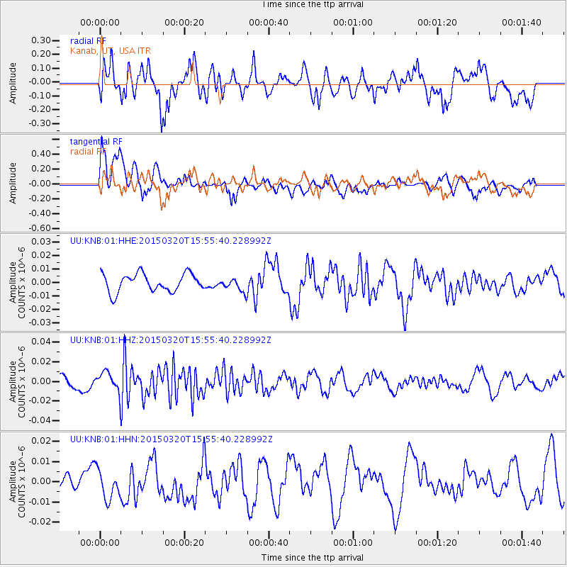
Signal To Noise
| Channel | StoN | STA | LTA |
| UU:KNB:01:HHZ:20150320T15:55:40.228992Z | 2.1852856 | 1.107384E-8 | 5.0674562E-9 |
| UU:KNB:01:HHN:20150320T15:55:40.228992Z | 1.0873454 | 8.415492E-9 | 7.739484E-9 |
| UU:KNB:01:HHE:20150320T15:55:40.228992Z | 0.64045113 | 4.3071324E-9 | 6.725154E-9 |
| Arrivals |
| Ps | |
| PpPs | |
| PsPs/PpSs | |


