You are here: Home > Network List > UW - Pacific Northwest Regional Seismic Network Stations List
> Station UMAT Pilot Rock, OR, USA > Earthquake Result Viewer
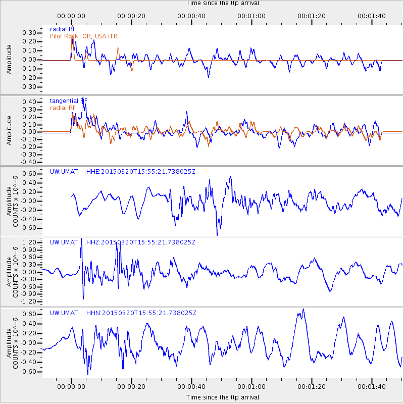
UMAT Pilot Rock, OR, USA - Earthquake Result Viewer
*The percent match for this event was below the threshold and hence no stack was calculated.
| Earthquake location: |
Solomon Islands |
| Earthquake latitude/longitude: |
-4.8/154.8 |
| Earthquake time(UTC): |
2015/03/20 (079) 15:42:52 GMT |
| Earthquake Depth: |
26 km |
| Earthquake Magnitude: |
5.5 MWB |
| Earthquake Catalog/Contributor: |
NEIC PDE/NEIC COMCAT |
|
| Network: |
UW Pacific Northwest Regional Seismic Network |
| Station: |
UMAT Pilot Rock, OR, USA |
| Lat/Lon: |
45.29 N/118.96 W |
| Elevation: |
1318 m |
|
| Distance: |
90.7 deg |
| Az: |
44.781 deg |
| Baz: |
263.967 deg |
| Ray Param: |
$rayparam |
*The percent match for this event was below the threshold and hence was not used in the summary stack. |
|
| Radial Match: |
60.5192 % |
| Radial Bump: |
400 |
| Transverse Match: |
67.582504 % |
| Transverse Bump: |
400 |
| SOD ConfigId: |
7422571 |
| Insert Time: |
2019-04-17 20:30:17.568 +0000 |
| GWidth: |
2.5 |
| Max Bumps: |
400 |
| Tol: |
0.001 |
|
Signal To Noise
| Channel | StoN | STA | LTA |
| UW:UMAT: :HHZ:20150320T15:55:21.738025Z | 2.8312347 | 4.666236E-7 | 1.6481276E-7 |
| UW:UMAT: :HHN:20150320T15:55:21.738025Z | 1.2477213 | 2.0997425E-7 | 1.6828616E-7 |
| UW:UMAT: :HHE:20150320T15:55:21.738025Z | 1.2603774 | 1.9705482E-7 | 1.5634588E-7 |
| Arrivals |
| Ps | |
| PpPs | |
| PsPs/PpSs | |


