
WRAB Tennant Creek, NT, Australia - Earthquake Result Viewer
| ||||||||||||||||||
| ||||||||||||||||||
| ||||||||||||||||||
|
Signal To Noise
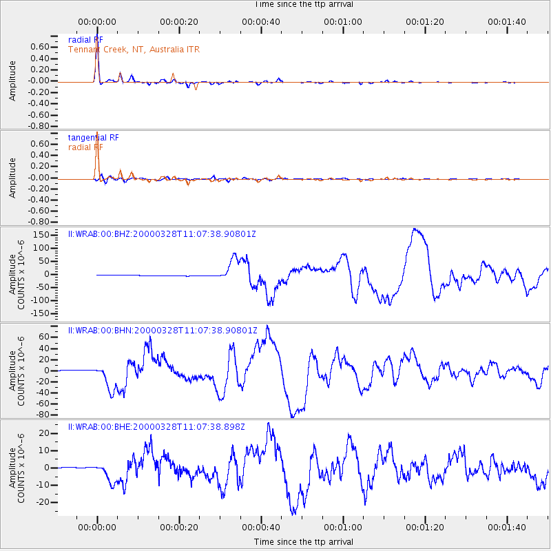
| Channel | StoN | STA | LTA |
| II:WRAB:00:BHN:20000328T11:07:38.90801Z | 25.538765 | 2.4988221E-5 | 9.784428E-7 |
| II:WRAB:00:BHE:20000328T11:07:38.898Z | 21.115118 | 6.047154E-6 | 2.863898E-7 |
| II:WRAB:00:BHZ:20000328T11:07:38.90801Z | 39.076195 | 4.499981E-5 | 1.1515914E-6 |
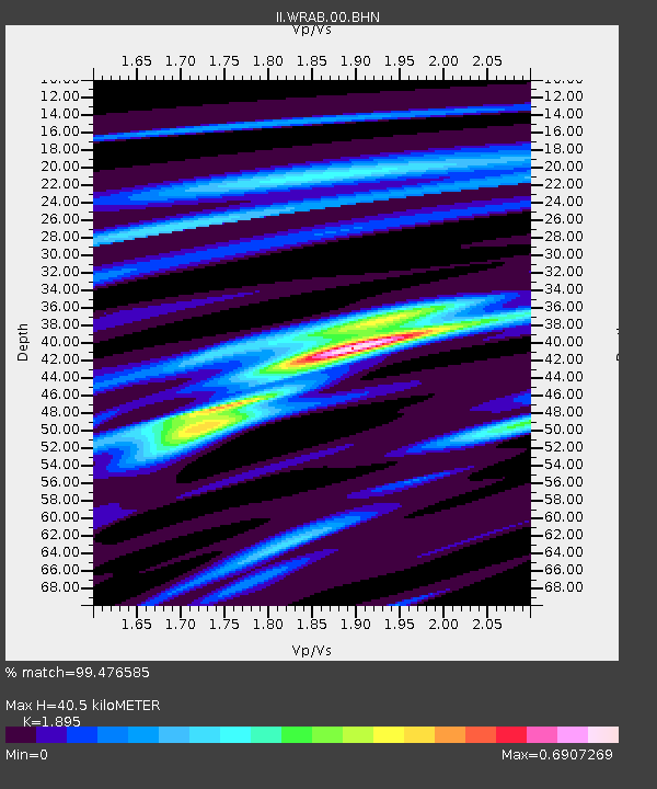
| Arrivals | |
| Ps | 5.8 SECOND |
| PpPs | 17 SECOND |
| PsPs/PpSs | 22 SECOND |

