You are here: Home > Network List > II - Global Seismograph Network (GSN - IRIS/IDA) Stations List
> Station WRAB Tennant Creek, NT, Australia > Earthquake Result Viewer
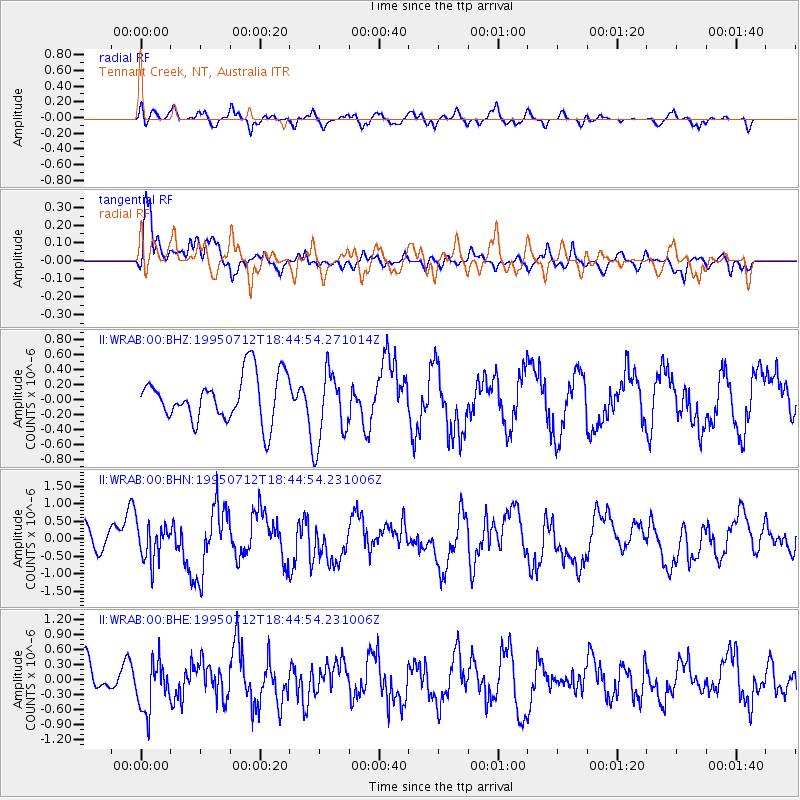
WRAB Tennant Creek, NT, Australia - Earthquake Result Viewer
*The percent match for this event was below the threshold and hence no stack was calculated.
| Earthquake location: |
Samar, Philippines |
| Earthquake latitude/longitude: |
12.3/125.0 |
| Earthquake time(UTC): |
1995/07/12 (193) 18:38:49 GMT |
| Earthquake Depth: |
33 km |
| Earthquake Magnitude: |
5.8 MB, 5.6 MS, 5.6 UNKNOWN, 6.0 MW |
| Earthquake Catalog/Contributor: |
WHDF/NEIC |
|
| Network: |
II Global Seismograph Network (GSN - IRIS/IDA) |
| Station: |
WRAB Tennant Creek, NT, Australia |
| Lat/Lon: |
19.93 S/134.36 E |
| Elevation: |
366 m |
|
| Distance: |
33.3 deg |
| Az: |
163.898 deg |
| Baz: |
343.256 deg |
| Ray Param: |
$rayparam |
*The percent match for this event was below the threshold and hence was not used in the summary stack. |
|
| Radial Match: |
55.824467 % |
| Radial Bump: |
400 |
| Transverse Match: |
74.7259 % |
| Transverse Bump: |
400 |
| SOD ConfigId: |
4480 |
| Insert Time: |
2010-03-01 23:24:52.927 +0000 |
| GWidth: |
2.5 |
| Max Bumps: |
400 |
| Tol: |
0.001 |
|
Signal To Noise
| Channel | StoN | STA | LTA |
| II:WRAB:00:BHN:19950712T18:44:54.231006Z | 1.5125881 | 5.07087E-7 | 3.352446E-7 |
| II:WRAB:00:BHE:19950712T18:44:54.231006Z | 1.89006 | 4.943014E-7 | 2.6152685E-7 |
| II:WRAB:00:BHZ:19950712T18:44:54.271014Z | 1.5847414 | 4.87055E-7 | 3.0734037E-7 |
| Arrivals |
| Ps | |
| PpPs | |
| PsPs/PpSs | |


