You are here: Home > Network List > II - Global Seismograph Network (GSN - IRIS/IDA) Stations List
> Station WRAB Tennant Creek, NT, Australia > Earthquake Result Viewer
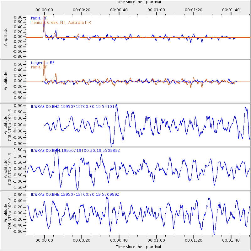
WRAB Tennant Creek, NT, Australia - Earthquake Result Viewer
*The percent match for this event was below the threshold and hence no stack was calculated.
| Earthquake location: |
Southeast Of Loyalty Islands |
| Earthquake latitude/longitude: |
-22.7/169.7 |
| Earthquake time(UTC): |
1995/07/19 (200) 00:24:17 GMT |
| Earthquake Depth: |
32 km |
| Earthquake Magnitude: |
5.8 MB, 5.6 MS, 5.4 UNKNOWN, 6.0 MW |
| Earthquake Catalog/Contributor: |
WHDF/NEIC |
|
| Network: |
II Global Seismograph Network (GSN - IRIS/IDA) |
| Station: |
WRAB Tennant Creek, NT, Australia |
| Lat/Lon: |
19.93 S/134.36 E |
| Elevation: |
366 m |
|
| Distance: |
33.0 deg |
| Az: |
268.019 deg |
| Baz: |
101.168 deg |
| Ray Param: |
$rayparam |
*The percent match for this event was below the threshold and hence was not used in the summary stack. |
|
| Radial Match: |
78.67007 % |
| Radial Bump: |
345 |
| Transverse Match: |
57.733562 % |
| Transverse Bump: |
400 |
| SOD ConfigId: |
4480 |
| Insert Time: |
2010-03-01 23:24:59.581 +0000 |
| GWidth: |
2.5 |
| Max Bumps: |
400 |
| Tol: |
0.001 |
|
Signal To Noise
| Channel | StoN | STA | LTA |
| II:WRAB:00:BHN:19950719T00:30:19.550989Z | 1.6781348 | 3.4531215E-7 | 2.057714E-7 |
| II:WRAB:00:BHE:19950719T00:30:19.550989Z | 2.4072053 | 3.213582E-7 | 1.3349846E-7 |
| II:WRAB:00:BHZ:19950719T00:30:19.54101Z | 0.9745939 | 1.8340688E-7 | 1.8818801E-7 |
| Arrivals |
| Ps | |
| PpPs | |
| PsPs/PpSs | |


