You are here: Home > Network List > II - Global Seismograph Network (GSN - IRIS/IDA) Stations List
> Station WRAB Tennant Creek, NT, Australia > Earthquake Result Viewer
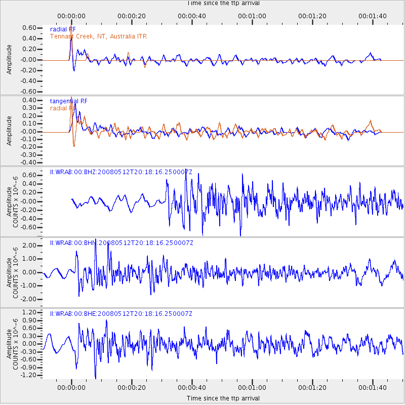
WRAB Tennant Creek, NT, Australia - Earthquake Result Viewer
*The percent match for this event was below the threshold and hence no stack was calculated.
| Earthquake location: |
Sichuan, China |
| Earthquake latitude/longitude: |
31.4/103.9 |
| Earthquake time(UTC): |
2008/05/12 (133) 20:08:50 GMT |
| Earthquake Depth: |
22 km |
| Earthquake Magnitude: |
5.7 MB, 5.5 MS, 5.6 MW, 5.5 MW |
| Earthquake Catalog/Contributor: |
WHDF/NEIC |
|
| Network: |
II Global Seismograph Network (GSN - IRIS/IDA) |
| Station: |
WRAB Tennant Creek, NT, Australia |
| Lat/Lon: |
19.93 S/134.36 E |
| Elevation: |
366 m |
|
| Distance: |
58.8 deg |
| Az: |
146.113 deg |
| Baz: |
329.556 deg |
| Ray Param: |
$rayparam |
*The percent match for this event was below the threshold and hence was not used in the summary stack. |
|
| Radial Match: |
52.469162 % |
| Radial Bump: |
400 |
| Transverse Match: |
75.61773 % |
| Transverse Bump: |
400 |
| SOD ConfigId: |
2504 |
| Insert Time: |
2010-03-01 23:25:09.059 +0000 |
| GWidth: |
2.5 |
| Max Bumps: |
400 |
| Tol: |
0.001 |
|
Signal To Noise
| Channel | StoN | STA | LTA |
| II:WRAB:00:BHN:20080512T20:18:16.250007Z | 4.4886594 | 7.525499E-7 | 1.6765583E-7 |
| II:WRAB:00:BHE:20080512T20:18:16.250007Z | 2.020298 | 4.010876E-7 | 1.9852894E-7 |
| II:WRAB:00:BHZ:20080512T20:18:16.250007Z | 2.339283 | 2.2771712E-7 | 9.734484E-8 |
| Arrivals |
| Ps | |
| PpPs | |
| PsPs/PpSs | |


