You are here: Home > Network List > CN - Canadian National Seismograph Network Stations List
> Station INK INUVIK, NT > Earthquake Result Viewer
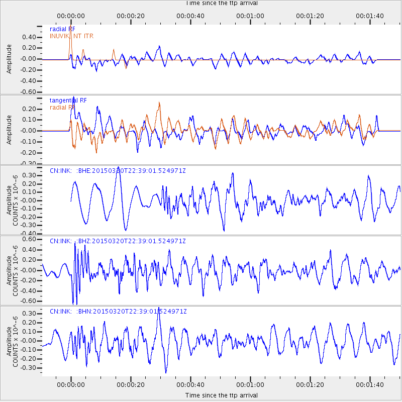
INK INUVIK, NT - Earthquake Result Viewer
*The percent match for this event was below the threshold and hence no stack was calculated.
| Earthquake location: |
Guerrero, Mexico |
| Earthquake latitude/longitude: |
18.0/-98.6 |
| Earthquake time(UTC): |
2015/03/20 (079) 22:30:07 GMT |
| Earthquake Depth: |
58 km |
| Earthquake Magnitude: |
5.4 MW, 5.3 mb, 4.6 MS |
| Earthquake Catalog/Contributor: |
ISC/ISC |
|
| Network: |
CN Canadian National Seismograph Network |
| Station: |
INK INUVIK, NT |
| Lat/Lon: |
68.31 N/133.53 W |
| Elevation: |
44 m |
|
| Distance: |
54.9 deg |
| Az: |
344.906 deg |
| Baz: |
138.197 deg |
| Ray Param: |
$rayparam |
*The percent match for this event was below the threshold and hence was not used in the summary stack. |
|
| Radial Match: |
54.639763 % |
| Radial Bump: |
400 |
| Transverse Match: |
57.163296 % |
| Transverse Bump: |
400 |
| SOD ConfigId: |
7422571 |
| Insert Time: |
2019-04-17 20:33:01.926 +0000 |
| GWidth: |
2.5 |
| Max Bumps: |
400 |
| Tol: |
0.001 |
|
Signal To Noise
| Channel | StoN | STA | LTA |
| CN:INK: :BHZ:20150320T22:39:01.524971Z | 1.6658057 | 3.1684903E-7 | 1.9020766E-7 |
| CN:INK: :BHN:20150320T22:39:01.524971Z | 0.8159213 | 9.0745935E-8 | 1.1121898E-7 |
| CN:INK: :BHE:20150320T22:39:01.524971Z | 0.5892408 | 1.07504945E-7 | 1.8244653E-7 |
| Arrivals |
| Ps | |
| PpPs | |
| PsPs/PpSs | |


