You are here: Home > Network List > II - Global Seismograph Network (GSN - IRIS/IDA) Stations List
> Station WRAB Tennant Creek, NT, Australia > Earthquake Result Viewer
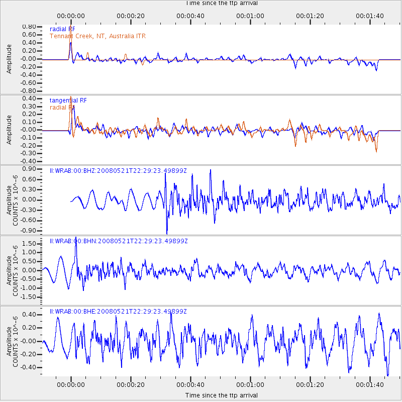
WRAB Tennant Creek, NT, Australia - Earthquake Result Viewer
*The percent match for this event was below the threshold and hence no stack was calculated.
| Earthquake location: |
Southern Sumatra, Indonesia |
| Earthquake latitude/longitude: |
-4.1/101.3 |
| Earthquake time(UTC): |
2008/05/21 (142) 22:22:55 GMT |
| Earthquake Depth: |
19 km |
| Earthquake Magnitude: |
5.5 MB, 5.2 MS, 5.5 MW, 5.4 MW |
| Earthquake Catalog/Contributor: |
WHDF/NEIC |
|
| Network: |
II Global Seismograph Network (GSN - IRIS/IDA) |
| Station: |
WRAB Tennant Creek, NT, Australia |
| Lat/Lon: |
19.93 S/134.36 E |
| Elevation: |
366 m |
|
| Distance: |
35.9 deg |
| Az: |
118.74 deg |
| Baz: |
291.631 deg |
| Ray Param: |
$rayparam |
*The percent match for this event was below the threshold and hence was not used in the summary stack. |
|
| Radial Match: |
50.97197 % |
| Radial Bump: |
400 |
| Transverse Match: |
65.913216 % |
| Transverse Bump: |
400 |
| SOD ConfigId: |
2504 |
| Insert Time: |
2010-03-01 23:25:13.034 +0000 |
| GWidth: |
2.5 |
| Max Bumps: |
400 |
| Tol: |
0.001 |
|
Signal To Noise
| Channel | StoN | STA | LTA |
| II:WRAB:00:BHN:20080521T22:29:23.49899Z | 3.2423496 | 7.069622E-7 | 2.180401E-7 |
| II:WRAB:00:BHE:20080521T22:29:23.49899Z | 1.3546158 | 1.5989349E-7 | 1.1803604E-7 |
| II:WRAB:00:BHZ:20080521T22:29:23.49899Z | 2.1572285 | 3.6600642E-7 | 1.6966511E-7 |
| Arrivals |
| Ps | |
| PpPs | |
| PsPs/PpSs | |


