You are here: Home > Network List > TA - USArray Transportable Network (new EarthScope stations) Stations List
> Station KSCO Kaye Shedlock's, Cheyenne Wells, CO, USA > Earthquake Result Viewer
KSCO Kaye Shedlock's, Cheyenne Wells, CO, USA - Earthquake Result Viewer

| Earthquake location: |
Rat Islands, Aleutian Islands |
| Earthquake latitude/longitude: |
51.8/178.8 |
| Earthquake time(UTC): |
2014/06/23 (174) 20:53:09 GMT |
| Earthquake Depth: |
108 km |
| Earthquake Magnitude: |
7.9 MWW, 7.1 MI, 7.9 MWC |
| Earthquake Catalog/Contributor: |
NEIC PDE/NEIC COMCAT |
|
| Network: |
TA USArray Transportable Network (new EarthScope stations) |
| Station: |
KSCO Kaye Shedlock's, Cheyenne Wells, CO, USA |
| Lat/Lon: |
39.01 N/102.63 W |
| Elevation: |
1382 m |
|
| Distance: |
54.1 deg |
| Az: |
70.614 deg |
| Baz: |
311.244 deg |
| Ray Param: |
0.06536116 |
| Estimated Moho Depth: |
48.0 km |
| Estimated Crust Vp/Vs: |
1.60 |
| Assumed Crust Vp: |
6.242 km/s |
| Estimated Crust Vs: |
3.901 km/s |
| Estimated Crust Poisson's Ratio: |
0.18 |
|
| Radial Match: |
95.51306 % |
| Radial Bump: |
329 |
| Transverse Match: |
74.33828 % |
| Transverse Bump: |
400 |
| SOD ConfigId: |
739768 |
| Insert Time: |
2014-07-07 21:51:54.137 +0000 |
| GWidth: |
2.5 |
| Max Bumps: |
400 |
| Tol: |
0.001 |
|
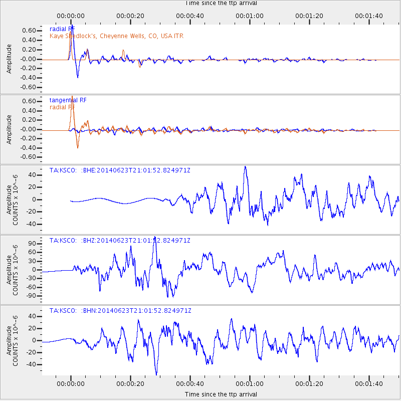
Signal To Noise
| Channel | StoN | STA | LTA |
| TA:KSCO: :BHZ:20140623T21:01:52.824971Z | 4.5952425 | 7.692166E-6 | 1.6739413E-6 |
| TA:KSCO: :BHN:20140623T21:01:52.824971Z | 2.8884225 | 3.14617E-6 | 1.0892347E-6 |
| TA:KSCO: :BHE:20140623T21:01:52.824971Z | 1.2707714 | 3.3931333E-6 | 2.6701364E-6 |
| Arrivals |
| Ps | 4.9 SECOND |
| PpPs | 19 SECOND |
| PsPs/PpSs | 24 SECOND |


