You are here: Home > Network List > II - Global Seismograph Network (GSN - IRIS/IDA) Stations List
> Station CMLA Cha de Macela, Sao Miguel Island, Azores > Earthquake Result Viewer
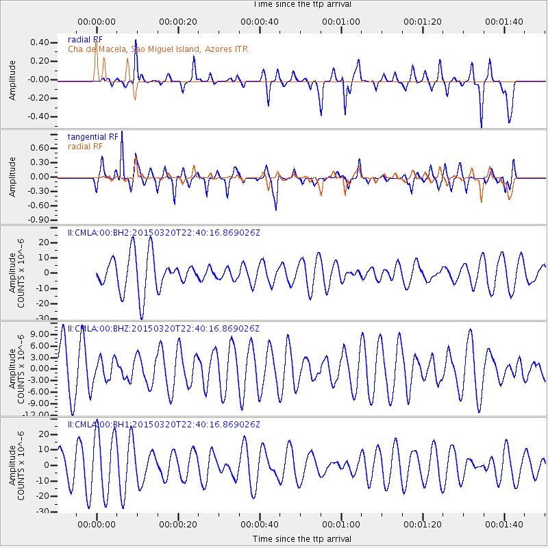
CMLA Cha de Macela, Sao Miguel Island, Azores - Earthquake Result Viewer
*The percent match for this event was below the threshold and hence no stack was calculated.
| Earthquake location: |
Guerrero, Mexico |
| Earthquake latitude/longitude: |
18.0/-98.6 |
| Earthquake time(UTC): |
2015/03/20 (079) 22:30:07 GMT |
| Earthquake Depth: |
58 km |
| Earthquake Magnitude: |
5.4 MW, 5.3 mb, 4.6 MS |
| Earthquake Catalog/Contributor: |
ISC/ISC |
|
| Network: |
II Global Seismograph Network (GSN - IRIS/IDA) |
| Station: |
CMLA Cha de Macela, Sao Miguel Island, Azores |
| Lat/Lon: |
37.76 N/25.52 W |
| Elevation: |
429 m |
|
| Distance: |
66.0 deg |
| Az: |
56.102 deg |
| Baz: |
274.655 deg |
| Ray Param: |
$rayparam |
*The percent match for this event was below the threshold and hence was not used in the summary stack. |
|
| Radial Match: |
28.722015 % |
| Radial Bump: |
241 |
| Transverse Match: |
70.88264 % |
| Transverse Bump: |
357 |
| SOD ConfigId: |
7422571 |
| Insert Time: |
2019-04-17 20:33:40.884 +0000 |
| GWidth: |
2.5 |
| Max Bumps: |
400 |
| Tol: |
0.001 |
|
Signal To Noise
| Channel | StoN | STA | LTA |
| II:CMLA:00:BHZ:20150320T22:40:16.869026Z | 0.5722139 | 2.7658264E-6 | 4.8335532E-6 |
| II:CMLA:00:BH1:20150320T22:40:16.869026Z | 2.207574 | 2.0198351E-5 | 9.149569E-6 |
| II:CMLA:00:BH2:20150320T22:40:16.869026Z | 0.28848106 | 3.2690418E-6 | 1.1331911E-5 |
| Arrivals |
| Ps | |
| PpPs | |
| PsPs/PpSs | |


