You are here: Home > Network List > II - Global Seismograph Network (GSN - IRIS/IDA) Stations List
> Station WRAB Tennant Creek, NT, Australia > Earthquake Result Viewer
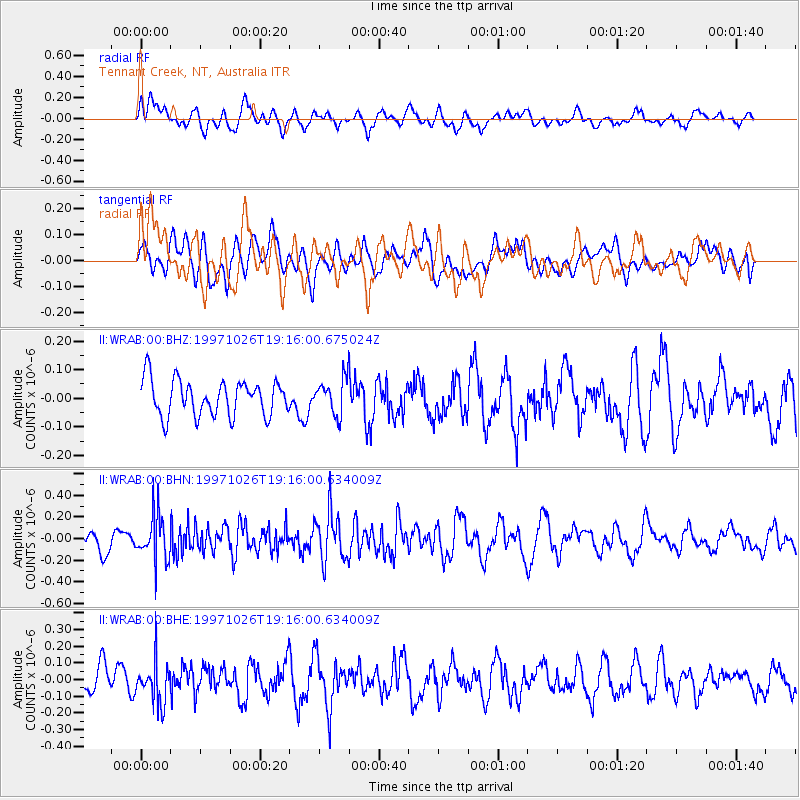
WRAB Tennant Creek, NT, Australia - Earthquake Result Viewer
*The percent match for this event was below the threshold and hence no stack was calculated.
| Earthquake location: |
Eastern Honshu, Japan |
| Earthquake latitude/longitude: |
39.3/140.5 |
| Earthquake time(UTC): |
1997/10/26 (299) 19:06:44 GMT |
| Earthquake Depth: |
134 km |
| Earthquake Magnitude: |
5.6 UNKNOWN, 5.2 MB |
| Earthquake Catalog/Contributor: |
WHDF/NEIC |
|
| Network: |
II Global Seismograph Network (GSN - IRIS/IDA) |
| Station: |
WRAB Tennant Creek, NT, Australia |
| Lat/Lon: |
19.93 S/134.36 E |
| Elevation: |
366 m |
|
| Distance: |
59.2 deg |
| Az: |
186.685 deg |
| Baz: |
5.51 deg |
| Ray Param: |
$rayparam |
*The percent match for this event was below the threshold and hence was not used in the summary stack. |
|
| Radial Match: |
63.329758 % |
| Radial Bump: |
400 |
| Transverse Match: |
52.63275 % |
| Transverse Bump: |
400 |
| SOD ConfigId: |
4480 |
| Insert Time: |
2010-03-01 23:25:19.437 +0000 |
| GWidth: |
2.5 |
| Max Bumps: |
400 |
| Tol: |
0.001 |
|
Signal To Noise
| Channel | StoN | STA | LTA |
| II:WRAB:00:BHN:19971026T19:16:00.634009Z | 2.1260672 | 2.1684154E-7 | 1.0199186E-7 |
| II:WRAB:00:BHE:19971026T19:16:00.634009Z | 1.6026839 | 1.275019E-7 | 7.955524E-8 |
| II:WRAB:00:BHZ:19971026T19:16:00.675024Z | 0.9972484 | 6.2097776E-8 | 6.2269116E-8 |
| Arrivals |
| Ps | |
| PpPs | |
| PsPs/PpSs | |


