You are here: Home > Network List > TA - USArray Transportable Network (new EarthScope stations) Stations List
> Station I23K Minto, Yukon-Koyukuk, AK, USA > Earthquake Result Viewer
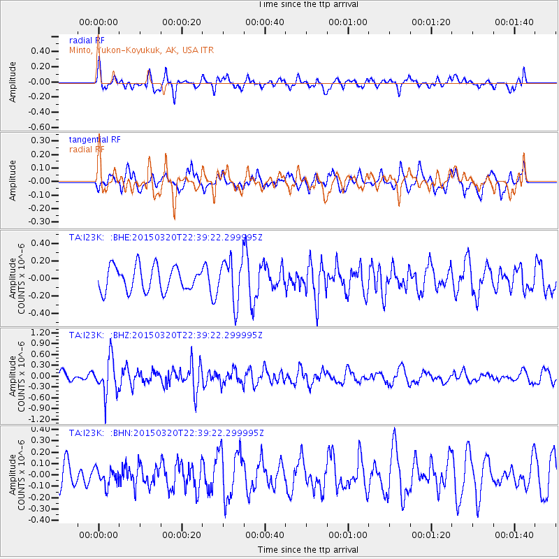
I23K Minto, Yukon-Koyukuk, AK, USA - Earthquake Result Viewer
*The percent match for this event was below the threshold and hence no stack was calculated.
| Earthquake location: |
Guerrero, Mexico |
| Earthquake latitude/longitude: |
18.0/-98.6 |
| Earthquake time(UTC): |
2015/03/20 (079) 22:30:07 GMT |
| Earthquake Depth: |
58 km |
| Earthquake Magnitude: |
5.4 MW, 5.3 mb, 4.6 MS |
| Earthquake Catalog/Contributor: |
ISC/ISC |
|
| Network: |
TA USArray Transportable Network (new EarthScope stations) |
| Station: |
I23K Minto, Yukon-Koyukuk, AK, USA |
| Lat/Lon: |
65.15 N/149.36 W |
| Elevation: |
149 m |
|
| Distance: |
57.8 deg |
| Az: |
337.238 deg |
| Baz: |
119.392 deg |
| Ray Param: |
$rayparam |
*The percent match for this event was below the threshold and hence was not used in the summary stack. |
|
| Radial Match: |
66.6016 % |
| Radial Bump: |
400 |
| Transverse Match: |
57.35015 % |
| Transverse Bump: |
400 |
| SOD ConfigId: |
7422571 |
| Insert Time: |
2019-04-17 20:35:02.751 +0000 |
| GWidth: |
2.5 |
| Max Bumps: |
400 |
| Tol: |
0.001 |
|
Signal To Noise
| Channel | StoN | STA | LTA |
| TA:I23K: :BHZ:20150320T22:39:22.299995Z | 2.7323496 | 5.102005E-7 | 1.8672593E-7 |
| TA:I23K: :BHN:20150320T22:39:22.299995Z | 0.43216756 | 7.499014E-8 | 1.7352099E-7 |
| TA:I23K: :BHE:20150320T22:39:22.299995Z | 1.834436 | 2.5568832E-7 | 1.3938252E-7 |
| Arrivals |
| Ps | |
| PpPs | |
| PsPs/PpSs | |


