You are here: Home > Network List > II - Global Seismograph Network (GSN - IRIS/IDA) Stations List
> Station WRAB Tennant Creek, NT, Australia > Earthquake Result Viewer
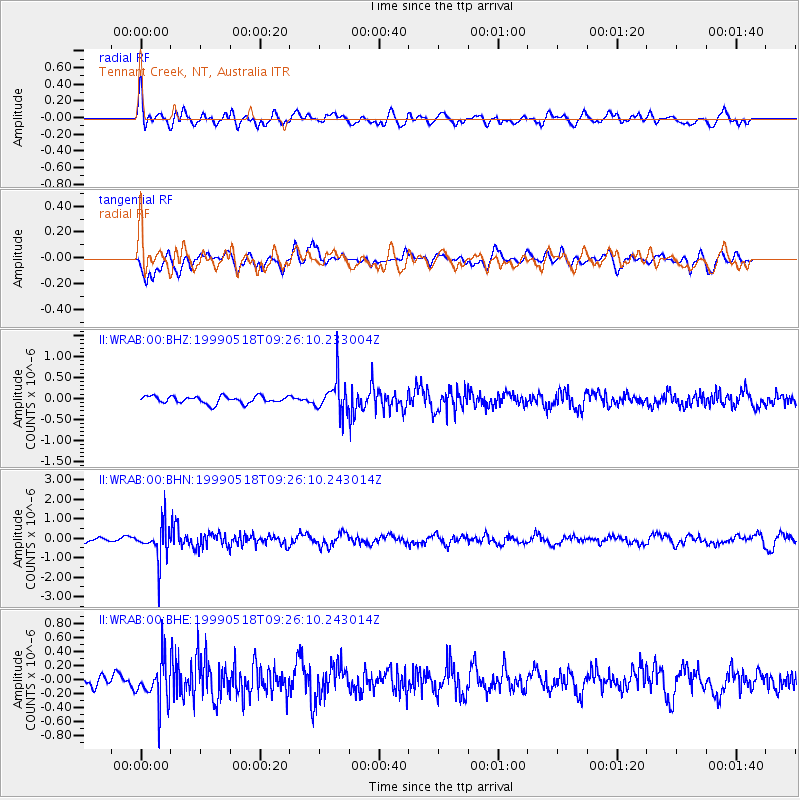
WRAB Tennant Creek, NT, Australia - Earthquake Result Viewer
*The percent match for this event was below the threshold and hence no stack was calculated.
| Earthquake location: |
North Island, New Zealand |
| Earthquake latitude/longitude: |
-38.7/175.3 |
| Earthquake time(UTC): |
1999/05/18 (138) 09:19:34 GMT |
| Earthquake Depth: |
282 km |
| Earthquake Magnitude: |
5.5 MB, 5.7 MW, 5.7 MW |
| Earthquake Catalog/Contributor: |
WHDF/NEIC |
|
| Network: |
II Global Seismograph Network (GSN - IRIS/IDA) |
| Station: |
WRAB Tennant Creek, NT, Australia |
| Lat/Lon: |
19.93 S/134.36 E |
| Elevation: |
366 m |
|
| Distance: |
39.9 deg |
| Az: |
286.054 deg |
| Baz: |
126.913 deg |
| Ray Param: |
$rayparam |
*The percent match for this event was below the threshold and hence was not used in the summary stack. |
|
| Radial Match: |
57.30091 % |
| Radial Bump: |
400 |
| Transverse Match: |
56.724995 % |
| Transverse Bump: |
400 |
| SOD ConfigId: |
4480 |
| Insert Time: |
2010-03-01 23:25:34.279 +0000 |
| GWidth: |
2.5 |
| Max Bumps: |
400 |
| Tol: |
0.001 |
|
Signal To Noise
| Channel | StoN | STA | LTA |
| II:WRAB:00:BHN:19990518T09:26:10.243014Z | 8.409909 | 9.353276E-7 | 1.11217325E-7 |
| II:WRAB:00:BHE:19990518T09:26:10.243014Z | 2.1249483 | 3.0850896E-7 | 1.4518422E-7 |
| II:WRAB:00:BHZ:19990518T09:26:10.233004Z | 4.7785273 | 4.134647E-7 | 8.6525546E-8 |
| Arrivals |
| Ps | |
| PpPs | |
| PsPs/PpSs | |


