You are here: Home > Network List > II - Global Seismograph Network (GSN - IRIS/IDA) Stations List
> Station WRAB Tennant Creek, NT, Australia > Earthquake Result Viewer
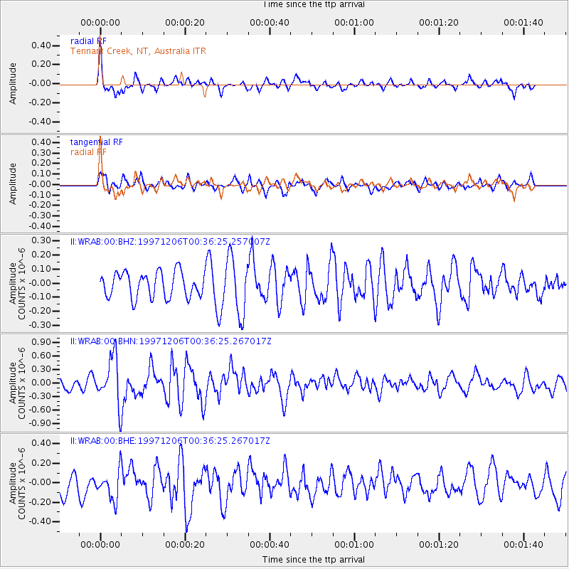
WRAB Tennant Creek, NT, Australia - Earthquake Result Viewer
*The percent match for this event was below the threshold and hence no stack was calculated.
| Earthquake location: |
Off East Coast Of Kamchatka |
| Earthquake latitude/longitude: |
53.7/161.6 |
| Earthquake time(UTC): |
1997/12/06 (340) 00:25:06 GMT |
| Earthquake Depth: |
33 km |
| Earthquake Magnitude: |
5.5 MS, 5.3 MB, 5.7 UNKNOWN |
| Earthquake Catalog/Contributor: |
WHDF/NEIC |
|
| Network: |
II Global Seismograph Network (GSN - IRIS/IDA) |
| Station: |
WRAB Tennant Creek, NT, Australia |
| Lat/Lon: |
19.93 S/134.36 E |
| Elevation: |
366 m |
|
| Distance: |
77.0 deg |
| Az: |
206.197 deg |
| Baz: |
16.187 deg |
| Ray Param: |
$rayparam |
*The percent match for this event was below the threshold and hence was not used in the summary stack. |
|
| Radial Match: |
72.71954 % |
| Radial Bump: |
386 |
| Transverse Match: |
64.453804 % |
| Transverse Bump: |
400 |
| SOD ConfigId: |
4480 |
| Insert Time: |
2010-03-01 23:25:54.021 +0000 |
| GWidth: |
2.5 |
| Max Bumps: |
400 |
| Tol: |
0.001 |
|
Signal To Noise
| Channel | StoN | STA | LTA |
| II:WRAB:00:BHN:19971206T00:36:25.267017Z | 4.2191763 | 5.357349E-7 | 1.2697618E-7 |
| II:WRAB:00:BHE:19971206T00:36:25.267017Z | 1.6812769 | 1.5377606E-7 | 9.1463846E-8 |
| II:WRAB:00:BHZ:19971206T00:36:25.257007Z | 2.2801192 | 2.026221E-7 | 8.8864695E-8 |
| Arrivals |
| Ps | |
| PpPs | |
| PsPs/PpSs | |


