You are here: Home > Network List > II - Global Seismograph Network (GSN - IRIS/IDA) Stations List
> Station WRAB Tennant Creek, NT, Australia > Earthquake Result Viewer
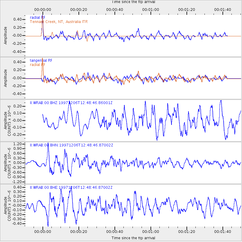
WRAB Tennant Creek, NT, Australia - Earthquake Result Viewer
*The percent match for this event was below the threshold and hence no stack was calculated.
| Earthquake location: |
Near East Coast Of Kamchatka |
| Earthquake latitude/longitude: |
54.9/162.1 |
| Earthquake time(UTC): |
1997/12/06 (340) 12:37:21 GMT |
| Earthquake Depth: |
33 km |
| Earthquake Magnitude: |
5.5 MB, 5.6 MS, 5.9 UNKNOWN, 5.8 MW |
| Earthquake Catalog/Contributor: |
WHDF/NEIC |
|
| Network: |
II Global Seismograph Network (GSN - IRIS/IDA) |
| Station: |
WRAB Tennant Creek, NT, Australia |
| Lat/Lon: |
19.93 S/134.36 E |
| Elevation: |
366 m |
|
| Distance: |
78.2 deg |
| Az: |
206.575 deg |
| Baz: |
15.932 deg |
| Ray Param: |
$rayparam |
*The percent match for this event was below the threshold and hence was not used in the summary stack. |
|
| Radial Match: |
72.906075 % |
| Radial Bump: |
400 |
| Transverse Match: |
61.101395 % |
| Transverse Bump: |
400 |
| SOD ConfigId: |
4480 |
| Insert Time: |
2010-03-01 23:25:57.966 +0000 |
| GWidth: |
2.5 |
| Max Bumps: |
400 |
| Tol: |
0.001 |
|
Signal To Noise
| Channel | StoN | STA | LTA |
| II:WRAB:00:BHN:19971206T12:48:46.87002Z | 4.2708125 | 4.5213525E-7 | 1.05866334E-7 |
| II:WRAB:00:BHE:19971206T12:48:46.87002Z | 2.1776946 | 1.8327877E-7 | 8.416183E-8 |
| II:WRAB:00:BHZ:19971206T12:48:46.86001Z | 0.79981405 | 8.159609E-8 | 1.0201883E-7 |
| Arrivals |
| Ps | |
| PpPs | |
| PsPs/PpSs | |


