You are here: Home > Network List > II - Global Seismograph Network (GSN - IRIS/IDA) Stations List
> Station WRAB Tennant Creek, NT, Australia > Earthquake Result Viewer
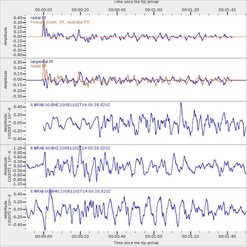
WRAB Tennant Creek, NT, Australia - Earthquake Result Viewer
*The percent match for this event was below the threshold and hence no stack was calculated.
| Earthquake location: |
Andreanof Islands, Aleutian Is. |
| Earthquake latitude/longitude: |
51.6/-174.4 |
| Earthquake time(UTC): |
2008/11/02 (307) 13:48:42 GMT |
| Earthquake Depth: |
36 km |
| Earthquake Magnitude: |
5.7 MB, 5.8 MS, 6.1 MW, 6.1 MW |
| Earthquake Catalog/Contributor: |
WHDF/NEIC |
|
| Network: |
II Global Seismograph Network (GSN - IRIS/IDA) |
| Station: |
WRAB Tennant Creek, NT, Australia |
| Lat/Lon: |
19.93 S/134.36 E |
| Elevation: |
366 m |
|
| Distance: |
84.1 deg |
| Az: |
227.551 deg |
| Baz: |
29.32 deg |
| Ray Param: |
$rayparam |
*The percent match for this event was below the threshold and hence was not used in the summary stack. |
|
| Radial Match: |
74.967896 % |
| Radial Bump: |
400 |
| Transverse Match: |
64.155235 % |
| Transverse Bump: |
400 |
| SOD ConfigId: |
2658 |
| Insert Time: |
2010-03-01 23:26:03.246 +0000 |
| GWidth: |
2.5 |
| Max Bumps: |
400 |
| Tol: |
0.001 |
|
Signal To Noise
| Channel | StoN | STA | LTA |
| II:WRAB:00:BHZ:20081102T14:00:38.820Z | 3.6548514 | 4.649836E-7 | 1.2722367E-7 |
| II:WRAB:00:BHN:20081102T14:00:38.820Z | 3.3967438 | 3.1176822E-7 | 9.1784436E-8 |
| II:WRAB:00:BHE:20081102T14:00:38.820Z | 1.5508214 | 1.4709818E-7 | 9.4851785E-8 |
| Arrivals |
| Ps | |
| PpPs | |
| PsPs/PpSs | |


