You are here: Home > Network List > II - Global Seismograph Network (GSN - IRIS/IDA) Stations List
> Station WRAB Tennant Creek, NT, Australia > Earthquake Result Viewer
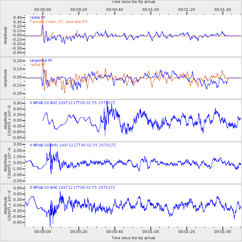
WRAB Tennant Creek, NT, Australia - Earthquake Result Viewer
*The percent match for this event was below the threshold and hence no stack was calculated.
| Earthquake location: |
Hindu Kush Region, Afghanistan |
| Earthquake latitude/longitude: |
36.4/70.8 |
| Earthquake time(UTC): |
1997/12/17 (351) 05:51:29 GMT |
| Earthquake Depth: |
207 km |
| Earthquake Magnitude: |
5.5 MB, 6.3 UNKNOWN |
| Earthquake Catalog/Contributor: |
WHDF/NEIC |
|
| Network: |
II Global Seismograph Network (GSN - IRIS/IDA) |
| Station: |
WRAB Tennant Creek, NT, Australia |
| Lat/Lon: |
19.93 S/134.36 E |
| Elevation: |
366 m |
|
| Distance: |
82.1 deg |
| Az: |
121.713 deg |
| Baz: |
313.145 deg |
| Ray Param: |
$rayparam |
*The percent match for this event was below the threshold and hence was not used in the summary stack. |
|
| Radial Match: |
61.30478 % |
| Radial Bump: |
400 |
| Transverse Match: |
72.97708 % |
| Transverse Bump: |
400 |
| SOD ConfigId: |
4480 |
| Insert Time: |
2010-03-01 23:26:06.723 +0000 |
| GWidth: |
2.5 |
| Max Bumps: |
400 |
| Tol: |
0.001 |
|
Signal To Noise
| Channel | StoN | STA | LTA |
| II:WRAB:00:BHN:19971217T06:02:55.267017Z | 2.373694 | 9.582812E-7 | 4.0370887E-7 |
| II:WRAB:00:BHE:19971217T06:02:55.267017Z | 1.3238789 | 3.5561646E-7 | 2.6861707E-7 |
| II:WRAB:00:BHZ:19971217T06:02:55.257007Z | 1.6456034 | 3.5671988E-7 | 2.1677148E-7 |
| Arrivals |
| Ps | |
| PpPs | |
| PsPs/PpSs | |


