You are here: Home > Network List > II - Global Seismograph Network (GSN - IRIS/IDA) Stations List
> Station WRAB Tennant Creek, NT, Australia > Earthquake Result Viewer
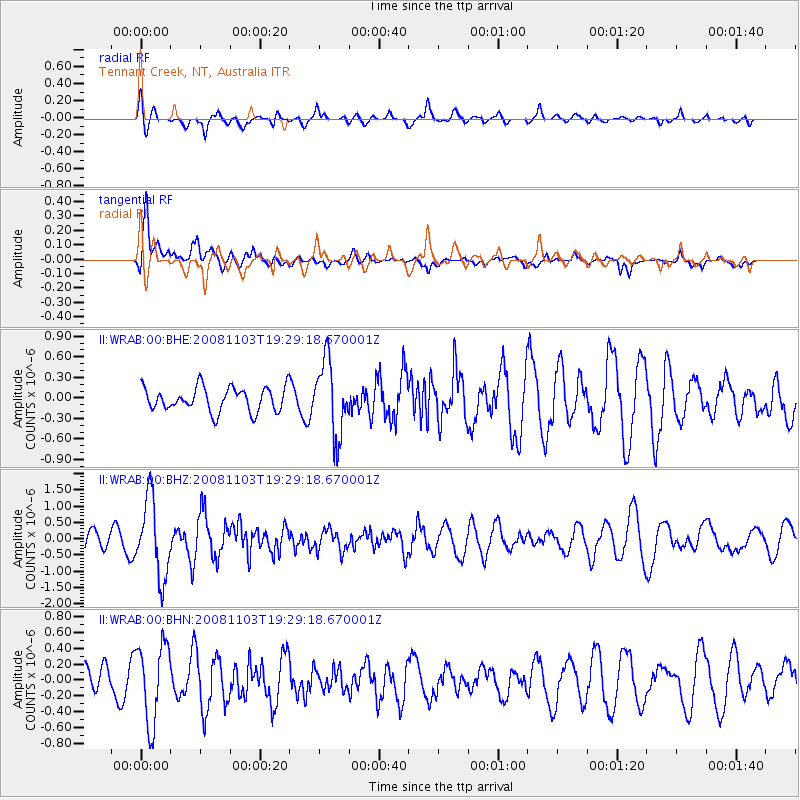
WRAB Tennant Creek, NT, Australia - Earthquake Result Viewer
*The percent match for this event was below the threshold and hence no stack was calculated.
| Earthquake location: |
Northern Sumatra, Indonesia |
| Earthquake latitude/longitude: |
1.1/97.3 |
| Earthquake time(UTC): |
2008/11/03 (308) 19:21:58 GMT |
| Earthquake Depth: |
10 km |
| Earthquake Magnitude: |
5.5 MB, 5.7 MS, 5.7 MW, 5.7 MW |
| Earthquake Catalog/Contributor: |
WHDF/NEIC |
|
| Network: |
II Global Seismograph Network (GSN - IRIS/IDA) |
| Station: |
WRAB Tennant Creek, NT, Australia |
| Lat/Lon: |
19.93 S/134.36 E |
| Elevation: |
366 m |
|
| Distance: |
42.0 deg |
| Az: |
121.932 deg |
| Baz: |
295.593 deg |
| Ray Param: |
$rayparam |
*The percent match for this event was below the threshold and hence was not used in the summary stack. |
|
| Radial Match: |
53.710682 % |
| Radial Bump: |
400 |
| Transverse Match: |
73.8607 % |
| Transverse Bump: |
400 |
| SOD ConfigId: |
2658 |
| Insert Time: |
2010-03-01 23:26:08.337 +0000 |
| GWidth: |
2.5 |
| Max Bumps: |
400 |
| Tol: |
0.001 |
|
Signal To Noise
| Channel | StoN | STA | LTA |
| II:WRAB:00:BHZ:20081103T19:29:18.670001Z | 2.9258513 | 1.1849894E-6 | 4.050067E-7 |
| II:WRAB:00:BHN:20081103T19:29:18.670001Z | 2.2260659 | 5.0078637E-7 | 2.2496478E-7 |
| II:WRAB:00:BHE:20081103T19:29:18.670001Z | 3.0870128 | 5.4022416E-7 | 1.74999E-7 |
| Arrivals |
| Ps | |
| PpPs | |
| PsPs/PpSs | |


