You are here: Home > Network List > II - Global Seismograph Network (GSN - IRIS/IDA) Stations List
> Station WRAB Tennant Creek, NT, Australia > Earthquake Result Viewer
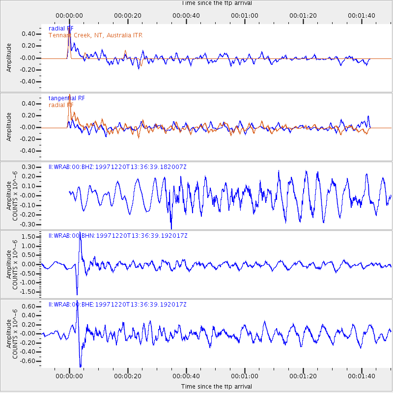
WRAB Tennant Creek, NT, Australia - Earthquake Result Viewer
*The percent match for this event was below the threshold and hence no stack was calculated.
| Earthquake location: |
Sea Of Okhotsk |
| Earthquake latitude/longitude: |
53.4/152.8 |
| Earthquake time(UTC): |
1997/12/20 (354) 13:26:31 GMT |
| Earthquake Depth: |
614 km |
| Earthquake Magnitude: |
5.9 UNKNOWN, 5.1 MB, 5.9 MW |
| Earthquake Catalog/Contributor: |
WHDF/NEIC |
|
| Network: |
II Global Seismograph Network (GSN - IRIS/IDA) |
| Station: |
WRAB Tennant Creek, NT, Australia |
| Lat/Lon: |
19.93 S/134.36 E |
| Elevation: |
366 m |
|
| Distance: |
74.8 deg |
| Az: |
197.928 deg |
| Baz: |
11.292 deg |
| Ray Param: |
$rayparam |
*The percent match for this event was below the threshold and hence was not used in the summary stack. |
|
| Radial Match: |
70.490295 % |
| Radial Bump: |
400 |
| Transverse Match: |
64.30334 % |
| Transverse Bump: |
400 |
| SOD ConfigId: |
4480 |
| Insert Time: |
2010-03-01 23:26:11.044 +0000 |
| GWidth: |
2.5 |
| Max Bumps: |
400 |
| Tol: |
0.001 |
|
Signal To Noise
| Channel | StoN | STA | LTA |
| II:WRAB:00:BHN:19971220T13:36:39.192017Z | 6.7973638 | 6.935359E-7 | 1.02030135E-7 |
| II:WRAB:00:BHE:19971220T13:36:39.192017Z | 4.5381565 | 3.3060118E-7 | 7.2849225E-8 |
| II:WRAB:00:BHZ:19971220T13:36:39.182007Z | 1.5106404 | 1.2892873E-7 | 8.534707E-8 |
| Arrivals |
| Ps | |
| PpPs | |
| PsPs/PpSs | |


