You are here: Home > Network List > II - Global Seismograph Network (GSN - IRIS/IDA) Stations List
> Station WRAB Tennant Creek, NT, Australia > Earthquake Result Viewer
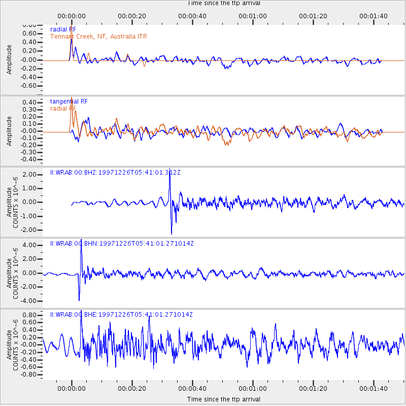
WRAB Tennant Creek, NT, Australia - Earthquake Result Viewer
*The percent match for this event was below the threshold and hence no stack was calculated.
| Earthquake location: |
South Of Fiji Islands |
| Earthquake latitude/longitude: |
-22.3/-179.7 |
| Earthquake time(UTC): |
1997/12/26 (360) 05:34:24 GMT |
| Earthquake Depth: |
588 km |
| Earthquake Magnitude: |
5.9 UNKNOWN, 5.3 MB, 5.8 MW |
| Earthquake Catalog/Contributor: |
WHDF/NEIC |
|
| Network: |
II Global Seismograph Network (GSN - IRIS/IDA) |
| Station: |
WRAB Tennant Creek, NT, Australia |
| Lat/Lon: |
19.93 S/134.36 E |
| Elevation: |
366 m |
|
| Distance: |
42.8 deg |
| Az: |
264.376 deg |
| Baz: |
101.663 deg |
| Ray Param: |
$rayparam |
*The percent match for this event was below the threshold and hence was not used in the summary stack. |
|
| Radial Match: |
69.740425 % |
| Radial Bump: |
400 |
| Transverse Match: |
55.843285 % |
| Transverse Bump: |
400 |
| SOD ConfigId: |
4480 |
| Insert Time: |
2010-03-01 23:26:17.140 +0000 |
| GWidth: |
2.5 |
| Max Bumps: |
400 |
| Tol: |
0.001 |
|
Signal To Noise
| Channel | StoN | STA | LTA |
| II:WRAB:00:BHN:19971226T05:41:01.271014Z | 7.898276 | 1.3902821E-6 | 1.760235E-7 |
| II:WRAB:00:BHE:19971226T05:41:01.271014Z | 2.5273278 | 2.836656E-7 | 1.1223934E-7 |
| II:WRAB:00:BHZ:19971226T05:41:01.312Z | 7.28489 | 7.980396E-7 | 1.0954724E-7 |
| Arrivals |
| Ps | |
| PpPs | |
| PsPs/PpSs | |


