You are here: Home > Network List > II - Global Seismograph Network (GSN - IRIS/IDA) Stations List
> Station WRAB Tennant Creek, NT, Australia > Earthquake Result Viewer
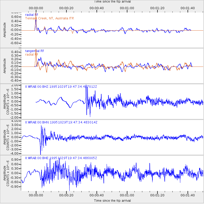
WRAB Tennant Creek, NT, Australia - Earthquake Result Viewer
*The percent match for this event was below the threshold and hence no stack was calculated.
| Earthquake location: |
Fiji Islands Region |
| Earthquake latitude/longitude: |
-21.7/-179.5 |
| Earthquake time(UTC): |
1995/10/29 (302) 19:40:57 GMT |
| Earthquake Depth: |
611 km |
| Earthquake Magnitude: |
5.7 MB, 6.1 UNKNOWN |
| Earthquake Catalog/Contributor: |
WHDF/NEIC |
|
| Network: |
II Global Seismograph Network (GSN - IRIS/IDA) |
| Station: |
WRAB Tennant Creek, NT, Australia |
| Lat/Lon: |
19.93 S/134.36 E |
| Elevation: |
366 m |
|
| Distance: |
43.1 deg |
| Az: |
263.643 deg |
| Baz: |
100.769 deg |
| Ray Param: |
$rayparam |
*The percent match for this event was below the threshold and hence was not used in the summary stack. |
|
| Radial Match: |
60.811348 % |
| Radial Bump: |
400 |
| Transverse Match: |
69.04816 % |
| Transverse Bump: |
400 |
| SOD ConfigId: |
4480 |
| Insert Time: |
2010-03-01 23:26:19.766 +0000 |
| GWidth: |
2.5 |
| Max Bumps: |
400 |
| Tol: |
0.001 |
|
Signal To Noise
| Channel | StoN | STA | LTA |
| II:WRAB:00:BHN:19951029T19:47:34.483014Z | 3.3864782 | 1.3084085E-6 | 3.8636261E-7 |
| II:WRAB:00:BHE:19951029T19:47:34.486005Z | 0.86806685 | 2.9944022E-7 | 3.4495062E-7 |
| II:WRAB:00:BHZ:19951029T19:47:34.487012Z | 2.224125 | 6.494624E-7 | 2.9200805E-7 |
| Arrivals |
| Ps | |
| PpPs | |
| PsPs/PpSs | |


