You are here: Home > Network List > II - Global Seismograph Network (GSN - IRIS/IDA) Stations List
> Station WRAB Tennant Creek, NT, Australia > Earthquake Result Viewer
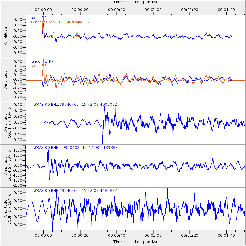
WRAB Tennant Creek, NT, Australia - Earthquake Result Viewer
*The percent match for this event was below the threshold and hence no stack was calculated.
| Earthquake location: |
Fiji Islands Region |
| Earthquake latitude/longitude: |
-15.1/-177.6 |
| Earthquake time(UTC): |
1994/04/02 (092) 15:34:44 GMT |
| Earthquake Depth: |
354 km |
| Earthquake Magnitude: |
5.5 MB |
| Earthquake Catalog/Contributor: |
WHDF/NEIC |
|
| Network: |
II Global Seismograph Network (GSN - IRIS/IDA) |
| Station: |
WRAB Tennant Creek, NT, Australia |
| Lat/Lon: |
19.93 S/134.36 E |
| Elevation: |
366 m |
|
| Distance: |
46.0 deg |
| Az: |
256.768 deg |
| Baz: |
91.986 deg |
| Ray Param: |
$rayparam |
*The percent match for this event was below the threshold and hence was not used in the summary stack. |
|
| Radial Match: |
51.182438 % |
| Radial Bump: |
400 |
| Transverse Match: |
57.702778 % |
| Transverse Bump: |
400 |
| SOD ConfigId: |
4480 |
| Insert Time: |
2010-03-01 23:26:27.497 +0000 |
| GWidth: |
2.5 |
| Max Bumps: |
400 |
| Tol: |
0.001 |
|
Signal To Noise
| Channel | StoN | STA | LTA |
| II:WRAB:00:BHN:19940402T15:42:03.418988Z | 7.0421677 | 6.4549965E-7 | 9.1662066E-8 |
| II:WRAB:00:BHE:19940402T15:42:03.418988Z | 1.7059205 | 1.5167892E-7 | 8.891324E-8 |
| II:WRAB:00:BHZ:19940402T15:42:03.400006Z | 3.5403621 | 3.71298E-7 | 1.0487571E-7 |
| Arrivals |
| Ps | |
| PpPs | |
| PsPs/PpSs | |


