You are here: Home > Network List > US - United States National Seismic Network Stations List
> Station HAWA Hanford, Washington, USA > Earthquake Result Viewer
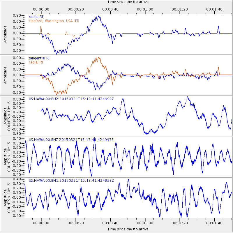
HAWA Hanford, Washington, USA - Earthquake Result Viewer
*The percent match for this event was below the threshold and hence no stack was calculated.
| Earthquake location: |
Mariana Islands |
| Earthquake latitude/longitude: |
13.1/145.8 |
| Earthquake time(UTC): |
2015/03/21 (080) 15:01:43 GMT |
| Earthquake Depth: |
10 km |
| Earthquake Magnitude: |
4.7 mb, 3.8 MS, 4.6 mb |
| Earthquake Catalog/Contributor: |
ISC/ISC |
|
| Network: |
US United States National Seismic Network |
| Station: |
HAWA Hanford, Washington, USA |
| Lat/Lon: |
46.39 N/119.53 W |
| Elevation: |
364 m |
|
| Distance: |
83.8 deg |
| Az: |
43.935 deg |
| Baz: |
282.411 deg |
| Ray Param: |
$rayparam |
*The percent match for this event was below the threshold and hence was not used in the summary stack. |
|
| Radial Match: |
39.448444 % |
| Radial Bump: |
400 |
| Transverse Match: |
42.71176 % |
| Transverse Bump: |
400 |
| SOD ConfigId: |
7422571 |
| Insert Time: |
2019-04-17 20:44:49.287 +0000 |
| GWidth: |
2.5 |
| Max Bumps: |
400 |
| Tol: |
0.001 |
|
Signal To Noise
| Channel | StoN | STA | LTA |
| US:HAWA:00:BHZ:20150321T15:13:41.424993Z | 0.35087213 | 9.006907E-8 | 2.5670056E-7 |
| US:HAWA:00:BH1:20150321T15:13:41.424993Z | 1.2681127 | 1.8103484E-7 | 1.4275926E-7 |
| US:HAWA:00:BH2:20150321T15:13:41.424993Z | 0.9971326 | 1.5386684E-7 | 1.543093E-7 |
| Arrivals |
| Ps | |
| PpPs | |
| PsPs/PpSs | |


