You are here: Home > Network List > II - Global Seismograph Network (GSN - IRIS/IDA) Stations List
> Station WRAB Tennant Creek, NT, Australia > Earthquake Result Viewer
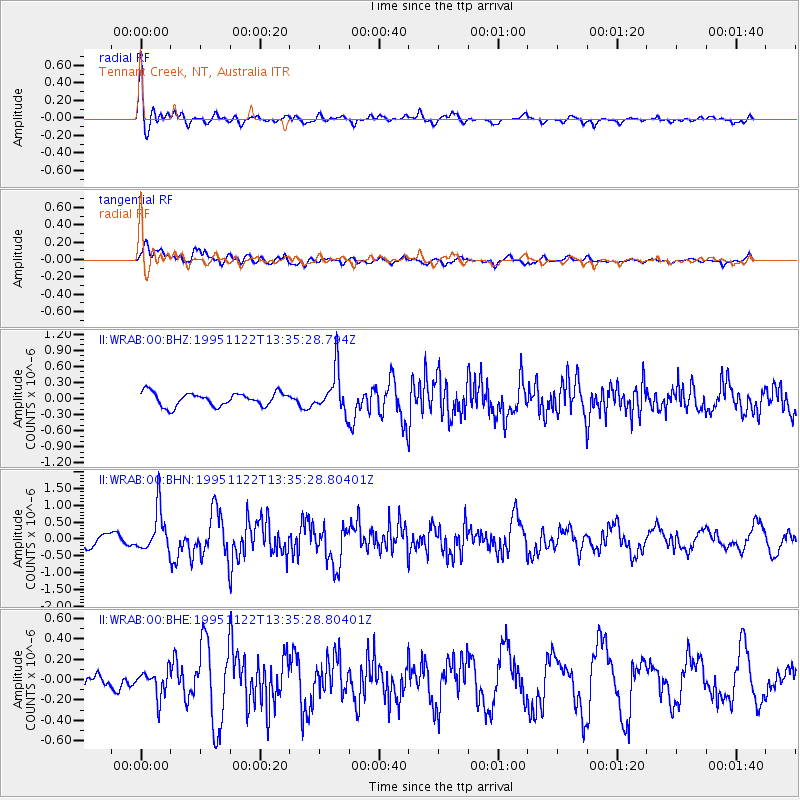
WRAB Tennant Creek, NT, Australia - Earthquake Result Viewer
*The percent match for this event was below the threshold and hence no stack was calculated.
| Earthquake location: |
Off W Coast Of Northern Sumatra |
| Earthquake latitude/longitude: |
3.1/95.9 |
| Earthquake time(UTC): |
1995/11/22 (326) 13:27:53 GMT |
| Earthquake Depth: |
28 km |
| Earthquake Magnitude: |
5.5 MB, 5.7 MS, 5.8 UNKNOWN, 5.8 MW |
| Earthquake Catalog/Contributor: |
WHDF/NEIC |
|
| Network: |
II Global Seismograph Network (GSN - IRIS/IDA) |
| Station: |
WRAB Tennant Creek, NT, Australia |
| Lat/Lon: |
19.93 S/134.36 E |
| Elevation: |
366 m |
|
| Distance: |
44.1 deg |
| Az: |
122.872 deg |
| Baz: |
296.945 deg |
| Ray Param: |
$rayparam |
*The percent match for this event was below the threshold and hence was not used in the summary stack. |
|
| Radial Match: |
74.68701 % |
| Radial Bump: |
400 |
| Transverse Match: |
73.98078 % |
| Transverse Bump: |
400 |
| SOD ConfigId: |
4480 |
| Insert Time: |
2010-03-01 23:26:42.735 +0000 |
| GWidth: |
2.5 |
| Max Bumps: |
400 |
| Tol: |
0.001 |
|
Signal To Noise
| Channel | StoN | STA | LTA |
| II:WRAB:00:BHN:19951122T13:35:28.80401Z | 3.3586497 | 6.3028074E-7 | 1.8765897E-7 |
| II:WRAB:00:BHE:19951122T13:35:28.80401Z | 1.4895022 | 1.3292188E-7 | 8.923913E-8 |
| II:WRAB:00:BHZ:19951122T13:35:28.794Z | 3.1420257 | 3.9137362E-7 | 1.2456093E-7 |
| Arrivals |
| Ps | |
| PpPs | |
| PsPs/PpSs | |


