You are here: Home > Network List > II - Global Seismograph Network (GSN - IRIS/IDA) Stations List
> Station WRAB Tennant Creek, NT, Australia > Earthquake Result Viewer
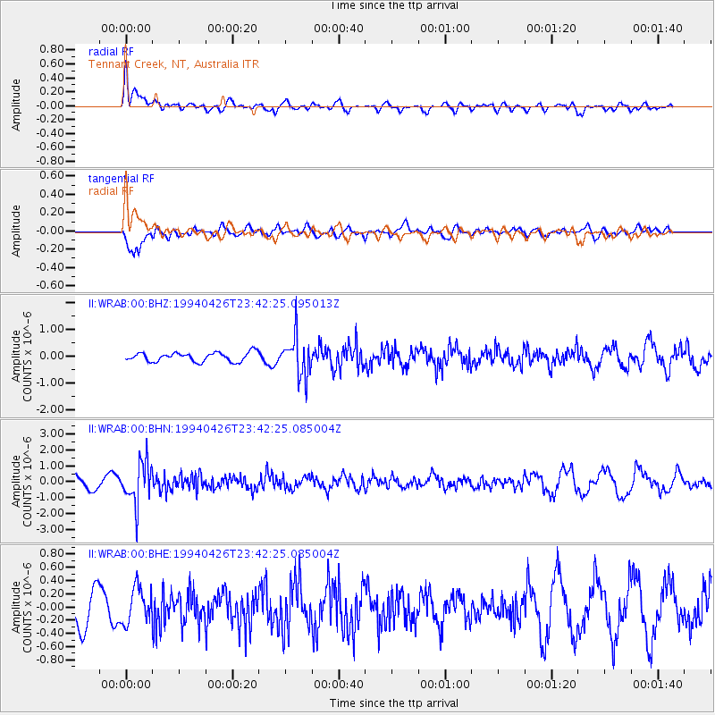
WRAB Tennant Creek, NT, Australia - Earthquake Result Viewer
*The percent match for this event was below the threshold and hence no stack was calculated.
| Earthquake location: |
Vanuatu Islands |
| Earthquake latitude/longitude: |
-16.0/168.0 |
| Earthquake time(UTC): |
1994/04/26 (116) 23:36:45 GMT |
| Earthquake Depth: |
187 km |
| Earthquake Magnitude: |
5.6 MB |
| Earthquake Catalog/Contributor: |
WHDF/NEIC |
|
| Network: |
II Global Seismograph Network (GSN - IRIS/IDA) |
| Station: |
WRAB Tennant Creek, NT, Australia |
| Lat/Lon: |
19.93 S/134.36 E |
| Elevation: |
366 m |
|
| Distance: |
32.2 deg |
| Az: |
257.952 deg |
| Baz: |
88.542 deg |
| Ray Param: |
$rayparam |
*The percent match for this event was below the threshold and hence was not used in the summary stack. |
|
| Radial Match: |
62.160904 % |
| Radial Bump: |
400 |
| Transverse Match: |
76.19348 % |
| Transverse Bump: |
400 |
| SOD ConfigId: |
4480 |
| Insert Time: |
2010-03-01 23:26:51.842 +0000 |
| GWidth: |
2.5 |
| Max Bumps: |
400 |
| Tol: |
0.001 |
|
Signal To Noise
| Channel | StoN | STA | LTA |
| II:WRAB:00:BHN:19940426T23:42:25.085004Z | 3.6689918 | 1.3463782E-6 | 3.6696136E-7 |
| II:WRAB:00:BHE:19940426T23:42:25.085004Z | 1.0970784 | 2.7069365E-7 | 2.4674046E-7 |
| II:WRAB:00:BHZ:19940426T23:42:25.095013Z | 4.560358 | 7.757192E-7 | 1.701005E-7 |
| Arrivals |
| Ps | |
| PpPs | |
| PsPs/PpSs | |


