You are here: Home > Network List > II - Global Seismograph Network (GSN - IRIS/IDA) Stations List
> Station WRAB Tennant Creek, NT, Australia > Earthquake Result Viewer
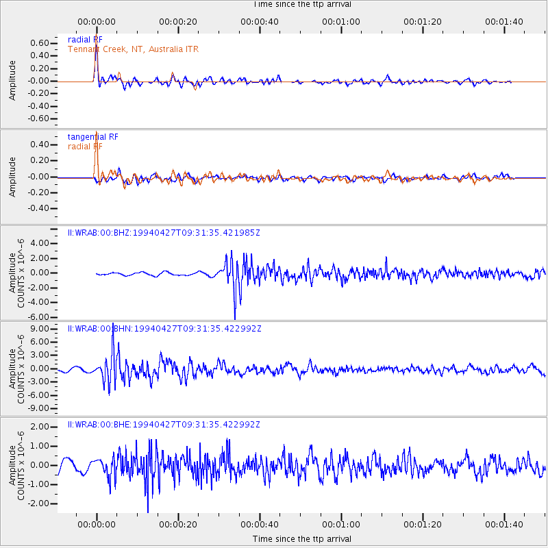
WRAB Tennant Creek, NT, Australia - Earthquake Result Viewer
*The percent match for this event was below the threshold and hence no stack was calculated.
| Earthquake location: |
Tonga Islands |
| Earthquake latitude/longitude: |
-21.5/-173.7 |
| Earthquake time(UTC): |
1994/04/27 (117) 09:23:27 GMT |
| Earthquake Depth: |
35 km |
| Earthquake Magnitude: |
6.2 MB, 6.1 MS, 6.0 UNKNOWN, 6.4 MW |
| Earthquake Catalog/Contributor: |
WHDF/NEIC |
|
| Network: |
II Global Seismograph Network (GSN - IRIS/IDA) |
| Station: |
WRAB Tennant Creek, NT, Australia |
| Lat/Lon: |
19.93 S/134.36 E |
| Elevation: |
366 m |
|
| Distance: |
48.4 deg |
| Az: |
261.969 deg |
| Baz: |
101.398 deg |
| Ray Param: |
$rayparam |
*The percent match for this event was below the threshold and hence was not used in the summary stack. |
|
| Radial Match: |
76.617096 % |
| Radial Bump: |
353 |
| Transverse Match: |
63.905033 % |
| Transverse Bump: |
400 |
| SOD ConfigId: |
4480 |
| Insert Time: |
2010-03-01 23:26:53.211 +0000 |
| GWidth: |
2.5 |
| Max Bumps: |
400 |
| Tol: |
0.001 |
|
Signal To Noise
| Channel | StoN | STA | LTA |
| II:WRAB:00:BHN:19940427T09:31:35.422992Z | 8.689246 | 3.1644042E-6 | 3.6417478E-7 |
| II:WRAB:00:BHE:19940427T09:31:35.422992Z | 1.9860709 | 4.932825E-7 | 2.4837107E-7 |
| II:WRAB:00:BHZ:19940427T09:31:35.421985Z | 9.621474 | 1.8290642E-6 | 1.9010228E-7 |
| Arrivals |
| Ps | |
| PpPs | |
| PsPs/PpSs | |


