You are here: Home > Network List > II - Global Seismograph Network (GSN - IRIS/IDA) Stations List
> Station WRAB Tennant Creek, NT, Australia > Earthquake Result Viewer
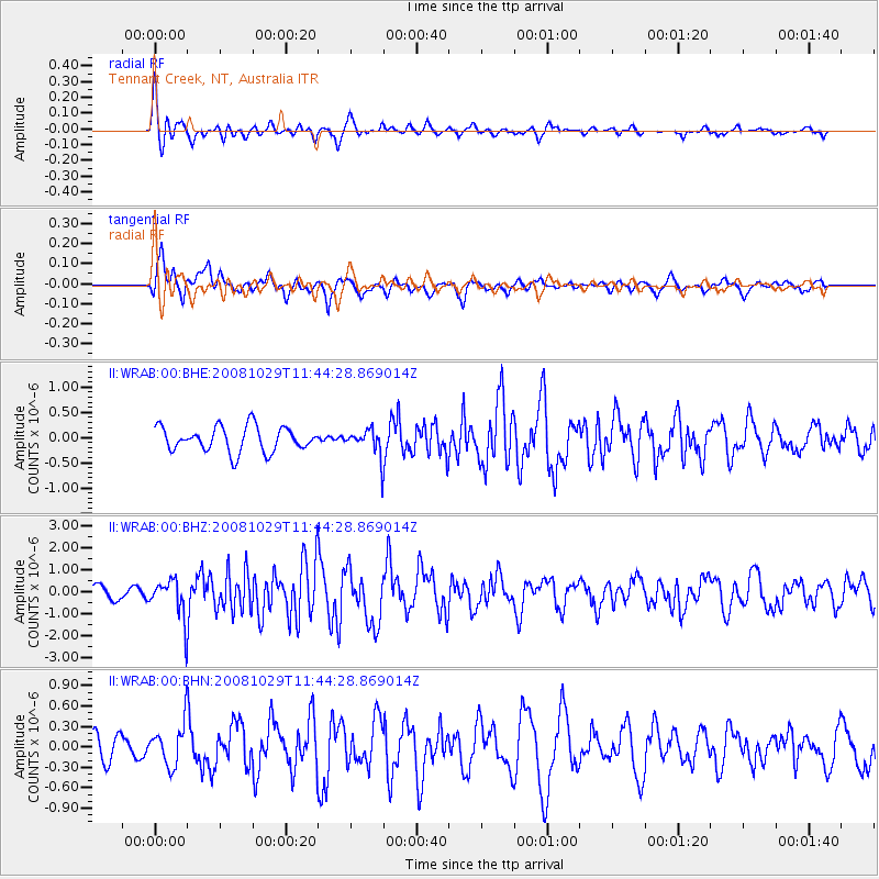
WRAB Tennant Creek, NT, Australia - Earthquake Result Viewer
*The percent match for this event was below the threshold and hence no stack was calculated.
| Earthquake location: |
Pakistan |
| Earthquake latitude/longitude: |
30.6/67.5 |
| Earthquake time(UTC): |
2008/10/29 (303) 11:32:43 GMT |
| Earthquake Depth: |
14 km |
| Earthquake Magnitude: |
6.2 MB, 6.6 MS, 6.4 MW, 6.4 MW |
| Earthquake Catalog/Contributor: |
WHDF/NEIC |
|
| Network: |
II Global Seismograph Network (GSN - IRIS/IDA) |
| Station: |
WRAB Tennant Creek, NT, Australia |
| Lat/Lon: |
19.93 S/134.36 E |
| Elevation: |
366 m |
|
| Distance: |
81.6 deg |
| Az: |
118.971 deg |
| Baz: |
306.697 deg |
| Ray Param: |
$rayparam |
*The percent match for this event was below the threshold and hence was not used in the summary stack. |
|
| Radial Match: |
68.68015 % |
| Radial Bump: |
352 |
| Transverse Match: |
73.10917 % |
| Transverse Bump: |
372 |
| SOD ConfigId: |
2560 |
| Insert Time: |
2010-03-01 23:26:57.964 +0000 |
| GWidth: |
2.5 |
| Max Bumps: |
400 |
| Tol: |
0.001 |
|
Signal To Noise
| Channel | StoN | STA | LTA |
| II:WRAB:00:BHZ:20081029T11:44:28.869014Z | 1.7189462 | 8.719005E-7 | 5.072297E-7 |
| II:WRAB:00:BHN:20081029T11:44:28.869014Z | 1.4536386 | 3.033331E-7 | 2.0867164E-7 |
| II:WRAB:00:BHE:20081029T11:44:28.869014Z | 1.0532136 | 2.59803E-7 | 2.4667645E-7 |
| Arrivals |
| Ps | |
| PpPs | |
| PsPs/PpSs | |


