You are here: Home > Network List > II - Global Seismograph Network (GSN - IRIS/IDA) Stations List
> Station WRAB Tennant Creek, NT, Australia > Earthquake Result Viewer
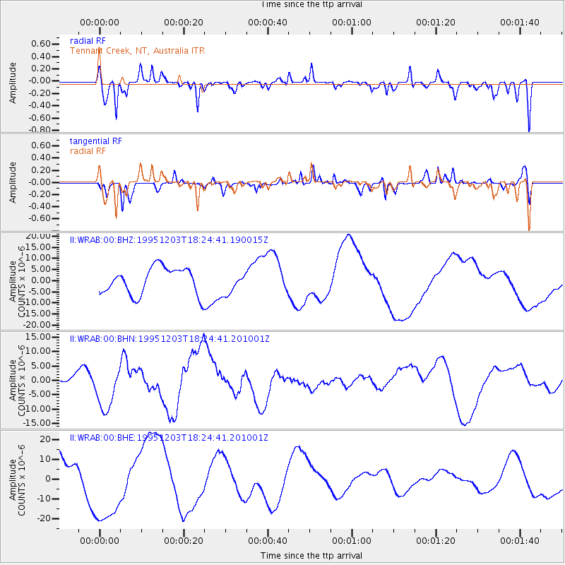
WRAB Tennant Creek, NT, Australia - Earthquake Result Viewer
*The percent match for this event was below the threshold and hence no stack was calculated.
| Earthquake location: |
East Of Kuril Islands |
| Earthquake latitude/longitude: |
44.8/150.7 |
| Earthquake time(UTC): |
1995/12/03 (337) 18:14:27 GMT |
| Earthquake Depth: |
33 km |
| Earthquake Magnitude: |
6.4 MB, 6.6 MS |
| Earthquake Catalog/Contributor: |
WHDF/NEIC |
|
| Network: |
II Global Seismograph Network (GSN - IRIS/IDA) |
| Station: |
WRAB Tennant Creek, NT, Australia |
| Lat/Lon: |
19.93 S/134.36 E |
| Elevation: |
366 m |
|
| Distance: |
66.2 deg |
| Az: |
196.807 deg |
| Baz: |
12.629 deg |
| Ray Param: |
$rayparam |
*The percent match for this event was below the threshold and hence was not used in the summary stack. |
|
| Radial Match: |
52.097183 % |
| Radial Bump: |
325 |
| Transverse Match: |
34.094494 % |
| Transverse Bump: |
269 |
| SOD ConfigId: |
4480 |
| Insert Time: |
2010-03-01 23:26:59.041 +0000 |
| GWidth: |
2.5 |
| Max Bumps: |
400 |
| Tol: |
0.001 |
|
Signal To Noise
| Channel | StoN | STA | LTA |
| II:WRAB:00:BHN:19951203T18:24:41.201001Z | 1.2852961 | 7.387759E-6 | 5.747904E-6 |
| II:WRAB:00:BHE:19951203T18:24:41.201001Z | 2.241079 | 2.0425023E-5 | 9.113924E-6 |
| II:WRAB:00:BHZ:19951203T18:24:41.190015Z | 0.79712194 | 4.8239704E-6 | 6.051734E-6 |
| Arrivals |
| Ps | |
| PpPs | |
| PsPs/PpSs | |


