You are here: Home > Network List > II - Global Seismograph Network (GSN - IRIS/IDA) Stations List
> Station CMLA Cha de Macela, Sao Miguel Island, Azores > Earthquake Result Viewer
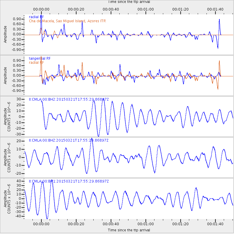
CMLA Cha de Macela, Sao Miguel Island, Azores - Earthquake Result Viewer
*The percent match for this event was below the threshold and hence no stack was calculated.
| Earthquake location: |
Afghanistan-Tajikistan Bord Reg. |
| Earthquake latitude/longitude: |
36.4/71.6 |
| Earthquake time(UTC): |
2015/03/21 (080) 17:44:37 GMT |
| Earthquake Depth: |
99 km |
| Earthquake Magnitude: |
4.9 MW, 4.8 mb |
| Earthquake Catalog/Contributor: |
ISC/ISC |
|
| Network: |
II Global Seismograph Network (GSN - IRIS/IDA) |
| Station: |
CMLA Cha de Macela, Sao Miguel Island, Azores |
| Lat/Lon: |
37.76 N/25.52 W |
| Elevation: |
429 m |
|
| Distance: |
73.7 deg |
| Az: |
304.974 deg |
| Baz: |
56.503 deg |
| Ray Param: |
$rayparam |
*The percent match for this event was below the threshold and hence was not used in the summary stack. |
|
| Radial Match: |
41.864853 % |
| Radial Bump: |
400 |
| Transverse Match: |
65.77636 % |
| Transverse Bump: |
325 |
| SOD ConfigId: |
7422571 |
| Insert Time: |
2019-04-17 20:47:42.158 +0000 |
| GWidth: |
2.5 |
| Max Bumps: |
400 |
| Tol: |
0.001 |
|
Signal To Noise
| Channel | StoN | STA | LTA |
| II:CMLA:00:BHZ:20150321T17:55:29.86897Z | 0.84847426 | 5.352274E-6 | 6.308116E-6 |
| II:CMLA:00:BH1:20150321T17:55:29.86897Z | 1.8762772 | 2.9176E-5 | 1.5549942E-5 |
| II:CMLA:00:BH2:20150321T17:55:29.86897Z | 2.5125883 | 2.1785321E-5 | 8.67047E-6 |
| Arrivals |
| Ps | |
| PpPs | |
| PsPs/PpSs | |


