You are here: Home > Network List > II - Global Seismograph Network (GSN - IRIS/IDA) Stations List
> Station WRAB Tennant Creek, NT, Australia > Earthquake Result Viewer
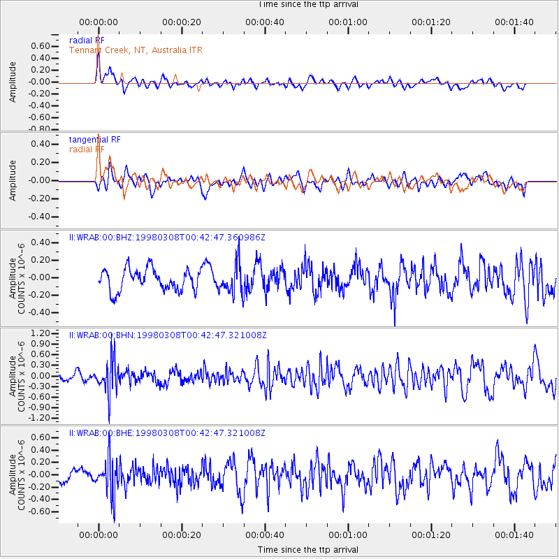
WRAB Tennant Creek, NT, Australia - Earthquake Result Viewer
*The percent match for this event was below the threshold and hence no stack was calculated.
| Earthquake location: |
Philippine Islands Region |
| Earthquake latitude/longitude: |
20.6/122.1 |
| Earthquake time(UTC): |
1998/03/08 (067) 00:35:42 GMT |
| Earthquake Depth: |
158 km |
| Earthquake Magnitude: |
5.5 MB, 5.9 UNKNOWN, 5.8 MW |
| Earthquake Catalog/Contributor: |
WHDF/NEIC |
|
| Network: |
II Global Seismograph Network (GSN - IRIS/IDA) |
| Station: |
WRAB Tennant Creek, NT, Australia |
| Lat/Lon: |
19.93 S/134.36 E |
| Elevation: |
366 m |
|
| Distance: |
42.0 deg |
| Az: |
162.692 deg |
| Baz: |
342.766 deg |
| Ray Param: |
$rayparam |
*The percent match for this event was below the threshold and hence was not used in the summary stack. |
|
| Radial Match: |
64.20747 % |
| Radial Bump: |
400 |
| Transverse Match: |
49.03158 % |
| Transverse Bump: |
400 |
| SOD ConfigId: |
4480 |
| Insert Time: |
2010-03-01 23:27:09.352 +0000 |
| GWidth: |
2.5 |
| Max Bumps: |
400 |
| Tol: |
0.001 |
|
Signal To Noise
| Channel | StoN | STA | LTA |
| II:WRAB:00:BHN:19980308T00:42:47.321008Z | 3.8395555 | 4.619645E-7 | 1.2031718E-7 |
| II:WRAB:00:BHE:19980308T00:42:47.321008Z | 2.9484732 | 2.9582057E-7 | 1.0033009E-7 |
| II:WRAB:00:BHZ:19980308T00:42:47.360986Z | 1.4639401 | 1.7978611E-7 | 1.2280974E-7 |
| Arrivals |
| Ps | |
| PpPs | |
| PsPs/PpSs | |


