You are here: Home > Network List > II - Global Seismograph Network (GSN - IRIS/IDA) Stations List
> Station WRAB Tennant Creek, NT, Australia > Earthquake Result Viewer
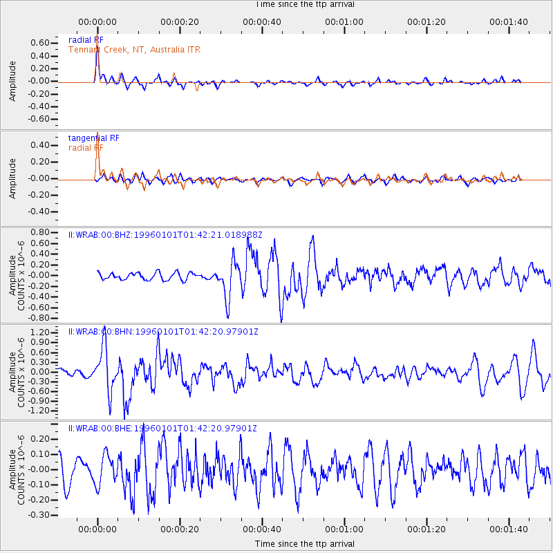
WRAB Tennant Creek, NT, Australia - Earthquake Result Viewer
*The percent match for this event was below the threshold and hence no stack was calculated.
| Earthquake location: |
Tonga Islands |
| Earthquake latitude/longitude: |
-20.3/-174.4 |
| Earthquake time(UTC): |
1996/01/01 (001) 01:34:15 GMT |
| Earthquake Depth: |
33 km |
| Earthquake Magnitude: |
5.8 MS, 5.3 MB |
| Earthquake Catalog/Contributor: |
WHDF/NEIC |
|
| Network: |
II Global Seismograph Network (GSN - IRIS/IDA) |
| Station: |
WRAB Tennant Creek, NT, Australia |
| Lat/Lon: |
19.93 S/134.36 E |
| Elevation: |
366 m |
|
| Distance: |
48.0 deg |
| Az: |
261.1 deg |
| Baz: |
99.748 deg |
| Ray Param: |
$rayparam |
*The percent match for this event was below the threshold and hence was not used in the summary stack. |
|
| Radial Match: |
77.84982 % |
| Radial Bump: |
276 |
| Transverse Match: |
59.246914 % |
| Transverse Bump: |
400 |
| SOD ConfigId: |
4480 |
| Insert Time: |
2010-03-01 23:27:12.317 +0000 |
| GWidth: |
2.5 |
| Max Bumps: |
400 |
| Tol: |
0.001 |
|
Signal To Noise
| Channel | StoN | STA | LTA |
| II:WRAB:00:BHN:19960101T01:42:20.97901Z | 5.959635 | 6.897193E-7 | 1.157318E-7 |
| II:WRAB:00:BHE:19960101T01:42:20.97901Z | 1.6250501 | 9.8717486E-8 | 6.0747354E-8 |
| II:WRAB:00:BHZ:19960101T01:42:21.018988Z | 5.2914658 | 3.450336E-7 | 6.5205676E-8 |
| Arrivals |
| Ps | |
| PpPs | |
| PsPs/PpSs | |


