You are here: Home > Network List > II - Global Seismograph Network (GSN - IRIS/IDA) Stations List
> Station WRAB Tennant Creek, NT, Australia > Earthquake Result Viewer
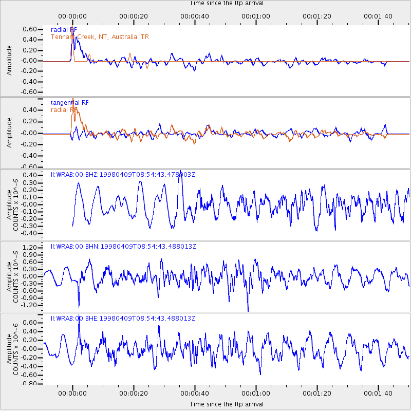
WRAB Tennant Creek, NT, Australia - Earthquake Result Viewer
*The percent match for this event was below the threshold and hence no stack was calculated.
| Earthquake location: |
Near East Coast Of Honshu, Japan |
| Earthquake latitude/longitude: |
36.9/140.8 |
| Earthquake time(UTC): |
1998/04/09 (099) 08:45:40 GMT |
| Earthquake Depth: |
111 km |
| Earthquake Magnitude: |
5.6 UNKNOWN, 5.3 MB, 5.5 MW |
| Earthquake Catalog/Contributor: |
WHDF/NEIC |
|
| Network: |
II Global Seismograph Network (GSN - IRIS/IDA) |
| Station: |
WRAB Tennant Creek, NT, Australia |
| Lat/Lon: |
19.93 S/134.36 E |
| Elevation: |
366 m |
|
| Distance: |
56.9 deg |
| Az: |
187.266 deg |
| Baz: |
6.185 deg |
| Ray Param: |
$rayparam |
*The percent match for this event was below the threshold and hence was not used in the summary stack. |
|
| Radial Match: |
71.98261 % |
| Radial Bump: |
400 |
| Transverse Match: |
59.93621 % |
| Transverse Bump: |
400 |
| SOD ConfigId: |
4480 |
| Insert Time: |
2010-03-01 23:27:16.877 +0000 |
| GWidth: |
2.5 |
| Max Bumps: |
400 |
| Tol: |
0.001 |
|
Signal To Noise
| Channel | StoN | STA | LTA |
| II:WRAB:00:BHN:19980409T08:54:43.488013Z | 1.6518713 | 3.393716E-7 | 2.0544677E-7 |
| II:WRAB:00:BHE:19980409T08:54:43.488013Z | 2.1544907 | 2.715534E-7 | 1.2604065E-7 |
| II:WRAB:00:BHZ:19980409T08:54:43.478003Z | 1.4093871 | 2.2336069E-7 | 1.5848072E-7 |
| Arrivals |
| Ps | |
| PpPs | |
| PsPs/PpSs | |


