You are here: Home > Network List > TA - USArray Transportable Network (new EarthScope stations) Stations List
> Station W59A Clinton, NC, USA > Earthquake Result Viewer
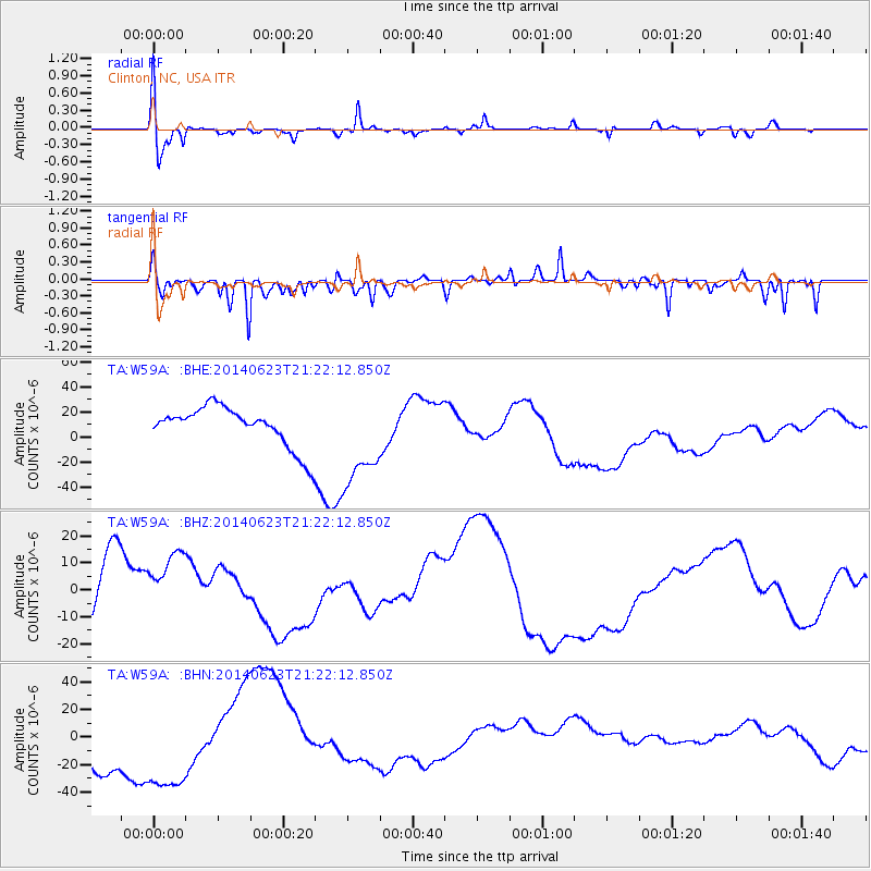
W59A Clinton, NC, USA - Earthquake Result Viewer
*The percent match for this event was below the threshold and hence no stack was calculated.
| Earthquake location: |
Rat Islands, Aleutian Islands |
| Earthquake latitude/longitude: |
52.0/178.4 |
| Earthquake time(UTC): |
2014/06/23 (174) 21:11:41 GMT |
| Earthquake Depth: |
107 km |
| Earthquake Magnitude: |
6.0 MB |
| Earthquake Catalog/Contributor: |
NEIC PDE/NEIC COMCAT |
|
| Network: |
TA USArray Transportable Network (new EarthScope stations) |
| Station: |
W59A Clinton, NC, USA |
| Lat/Lon: |
35.17 N/78.44 W |
| Elevation: |
60 m |
|
| Distance: |
70.4 deg |
| Az: |
57.866 deg |
| Baz: |
320.247 deg |
| Ray Param: |
$rayparam |
*The percent match for this event was below the threshold and hence was not used in the summary stack. |
|
| Radial Match: |
59.739235 % |
| Radial Bump: |
400 |
| Transverse Match: |
46.192116 % |
| Transverse Bump: |
296 |
| SOD ConfigId: |
739768 |
| Insert Time: |
2014-07-07 22:47:27.949 +0000 |
| GWidth: |
2.5 |
| Max Bumps: |
400 |
| Tol: |
0.001 |
|
Signal To Noise
| Channel | StoN | STA | LTA |
| TA:W59A: :BHZ:20140623T21:22:12.850Z | 1.1454307 | 1.4004125E-5 | 1.2226078E-5 |
| TA:W59A: :BHN:20140623T21:22:12.850Z | 2.10055 | 4.2407297E-5 | 2.0188663E-5 |
| TA:W59A: :BHE:20140623T21:22:12.850Z | 2.3786364 | 3.810778E-5 | 1.6020853E-5 |
| Arrivals |
| Ps | |
| PpPs | |
| PsPs/PpSs | |


