You are here: Home > Network List > TA - USArray Transportable Network (new EarthScope stations) Stations List
> Station Y57A Sumter, SC, USA > Earthquake Result Viewer
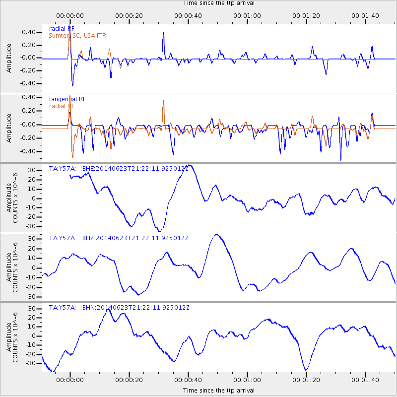
Y57A Sumter, SC, USA - Earthquake Result Viewer
*The percent match for this event was below the threshold and hence no stack was calculated.
| Earthquake location: |
Rat Islands, Aleutian Islands |
| Earthquake latitude/longitude: |
52.0/178.4 |
| Earthquake time(UTC): |
2014/06/23 (174) 21:11:41 GMT |
| Earthquake Depth: |
107 km |
| Earthquake Magnitude: |
6.0 MB |
| Earthquake Catalog/Contributor: |
NEIC PDE/NEIC COMCAT |
|
| Network: |
TA USArray Transportable Network (new EarthScope stations) |
| Station: |
Y57A Sumter, SC, USA |
| Lat/Lon: |
34.02 N/80.39 W |
| Elevation: |
56 m |
|
| Distance: |
70.3 deg |
| Az: |
59.957 deg |
| Baz: |
319.849 deg |
| Ray Param: |
$rayparam |
*The percent match for this event was below the threshold and hence was not used in the summary stack. |
|
| Radial Match: |
70.81347 % |
| Radial Bump: |
400 |
| Transverse Match: |
39.8687 % |
| Transverse Bump: |
400 |
| SOD ConfigId: |
739768 |
| Insert Time: |
2014-07-07 22:48:08.630 +0000 |
| GWidth: |
2.5 |
| Max Bumps: |
400 |
| Tol: |
0.001 |
|
Signal To Noise
| Channel | StoN | STA | LTA |
| TA:Y57A: :BHZ:20140623T21:22:11.925012Z | 2.1136146 | 1.7118895E-5 | 8.099346E-6 |
| TA:Y57A: :BHN:20140623T21:22:11.925012Z | 0.78348273 | 1.5409261E-5 | 1.9667646E-5 |
| TA:Y57A: :BHE:20140623T21:22:11.925012Z | 1.4451404 | 2.7392069E-5 | 1.8954608E-5 |
| Arrivals |
| Ps | |
| PpPs | |
| PsPs/PpSs | |


