You are here: Home > Network List > II - Global Seismograph Network (GSN - IRIS/IDA) Stations List
> Station WRAB Tennant Creek, NT, Australia > Earthquake Result Viewer
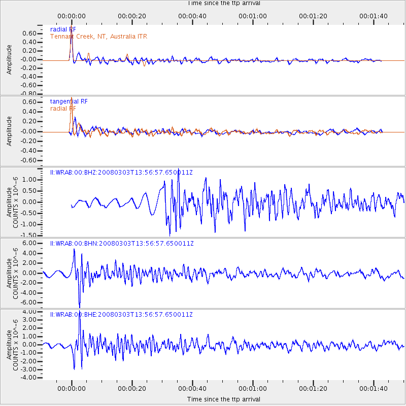
WRAB Tennant Creek, NT, Australia - Earthquake Result Viewer
*The percent match for this event was below the threshold and hence no stack was calculated.
| Earthquake location: |
Philippine Islands Region |
| Earthquake latitude/longitude: |
19.9/121.3 |
| Earthquake time(UTC): |
2008/03/03 (063) 13:49:40 GMT |
| Earthquake Depth: |
10 km |
| Earthquake Magnitude: |
6.0 MB, 6.0 MW, 5.9 MW |
| Earthquake Catalog/Contributor: |
WHDF/NEIC |
|
| Network: |
II Global Seismograph Network (GSN - IRIS/IDA) |
| Station: |
WRAB Tennant Creek, NT, Australia |
| Lat/Lon: |
19.93 S/134.36 E |
| Elevation: |
366 m |
|
| Distance: |
41.6 deg |
| Az: |
161.376 deg |
| Baz: |
341.374 deg |
| Ray Param: |
$rayparam |
*The percent match for this event was below the threshold and hence was not used in the summary stack. |
|
| Radial Match: |
74.27163 % |
| Radial Bump: |
400 |
| Transverse Match: |
73.103645 % |
| Transverse Bump: |
400 |
| SOD ConfigId: |
2504 |
| Insert Time: |
2010-03-01 23:27:36.698 +0000 |
| GWidth: |
2.5 |
| Max Bumps: |
400 |
| Tol: |
0.001 |
|
Signal To Noise
| Channel | StoN | STA | LTA |
| II:WRAB:00:BHN:20080303T13:56:57.650011Z | 7.666643 | 2.655134E-6 | 3.4632288E-7 |
| II:WRAB:00:BHE:20080303T13:56:57.650011Z | 7.0176077 | 1.5036277E-6 | 2.1426499E-7 |
| II:WRAB:00:BHZ:20080303T13:56:57.650011Z | 4.797563 | 7.425695E-7 | 1.5478057E-7 |
| Arrivals |
| Ps | |
| PpPs | |
| PsPs/PpSs | |


