You are here: Home > Network List > II - Global Seismograph Network (GSN - IRIS/IDA) Stations List
> Station WRAB Tennant Creek, NT, Australia > Earthquake Result Viewer
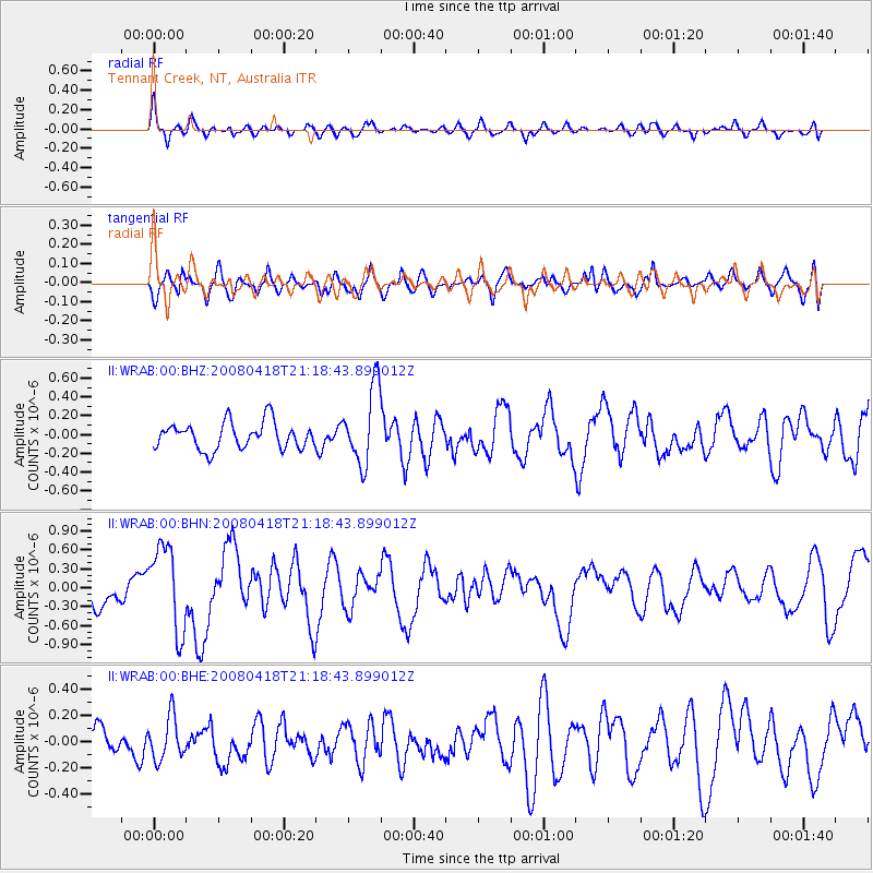
WRAB Tennant Creek, NT, Australia - Earthquake Result Viewer
*The percent match for this event was below the threshold and hence no stack was calculated.
| Earthquake location: |
Kermadec Islands Region |
| Earthquake latitude/longitude: |
-27.5/-176.6 |
| Earthquake time(UTC): |
2008/04/18 (109) 21:10:56 GMT |
| Earthquake Depth: |
10 km |
| Earthquake Magnitude: |
5.6 MS, 5.4 MB, 5.8 MW, 5.8 MW |
| Earthquake Catalog/Contributor: |
WHDF/NEIC |
|
| Network: |
II Global Seismograph Network (GSN - IRIS/IDA) |
| Station: |
WRAB Tennant Creek, NT, Australia |
| Lat/Lon: |
19.93 S/134.36 E |
| Elevation: |
366 m |
|
| Distance: |
45.3 deg |
| Az: |
268.586 deg |
| Baz: |
109.33 deg |
| Ray Param: |
$rayparam |
*The percent match for this event was below the threshold and hence was not used in the summary stack. |
|
| Radial Match: |
64.93312 % |
| Radial Bump: |
400 |
| Transverse Match: |
58.21158 % |
| Transverse Bump: |
400 |
| SOD ConfigId: |
2504 |
| Insert Time: |
2010-03-01 23:27:51.626 +0000 |
| GWidth: |
2.5 |
| Max Bumps: |
400 |
| Tol: |
0.001 |
|
Signal To Noise
| Channel | StoN | STA | LTA |
| II:WRAB:00:BHN:20080418T21:18:43.899012Z | 3.341996 | 6.7778916E-7 | 2.0280969E-7 |
| II:WRAB:00:BHE:20080418T21:18:43.899012Z | 1.4335458 | 1.6291317E-7 | 1.136435E-7 |
| II:WRAB:00:BHZ:20080418T21:18:43.899012Z | 2.8740664 | 4.067617E-7 | 1.4152829E-7 |
| Arrivals |
| Ps | |
| PpPs | |
| PsPs/PpSs | |


