You are here: Home > Network List > TA - USArray Transportable Network (new EarthScope stations) Stations List
> Station T54A Tazewell, VA, USA > Earthquake Result Viewer
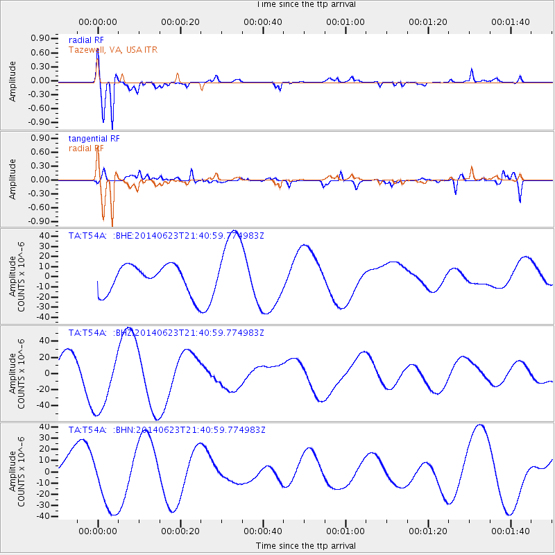
T54A Tazewell, VA, USA - Earthquake Result Viewer
*The percent match for this event was below the threshold and hence no stack was calculated.
| Earthquake location: |
Rat Islands, Aleutian Islands |
| Earthquake latitude/longitude: |
52.0/178.4 |
| Earthquake time(UTC): |
2014/06/23 (174) 21:30:47 GMT |
| Earthquake Depth: |
109 km |
| Earthquake Magnitude: |
5.9 MB |
| Earthquake Catalog/Contributor: |
NEIC PDE/NEIC COMCAT |
|
| Network: |
TA USArray Transportable Network (new EarthScope stations) |
| Station: |
T54A Tazewell, VA, USA |
| Lat/Lon: |
37.06 N/81.58 W |
| Elevation: |
852 m |
|
| Distance: |
67.3 deg |
| Az: |
58.592 deg |
| Baz: |
318.725 deg |
| Ray Param: |
$rayparam |
*The percent match for this event was below the threshold and hence was not used in the summary stack. |
|
| Radial Match: |
84.205574 % |
| Radial Bump: |
400 |
| Transverse Match: |
63.231678 % |
| Transverse Bump: |
400 |
| SOD ConfigId: |
739768 |
| Insert Time: |
2014-07-07 23:18:33.934 +0000 |
| GWidth: |
2.5 |
| Max Bumps: |
400 |
| Tol: |
0.001 |
|
Signal To Noise
| Channel | StoN | STA | LTA |
| TA:T54A: :BHZ:20140623T21:40:59.774983Z | 2.849988 | 3.801279E-5 | 1.3337877E-5 |
| TA:T54A: :BHN:20140623T21:40:59.774983Z | 2.1928673 | 2.7515414E-5 | 1.2547688E-5 |
| TA:T54A: :BHE:20140623T21:40:59.774983Z | 2.6254394 | 3.6582656E-5 | 1.3933917E-5 |
| Arrivals |
| Ps | |
| PpPs | |
| PsPs/PpSs | |


