You are here: Home > Network List > UW - Pacific Northwest Regional Seismic Network Stations List
> Station MRBL Marblemount, WA, USA > Earthquake Result Viewer
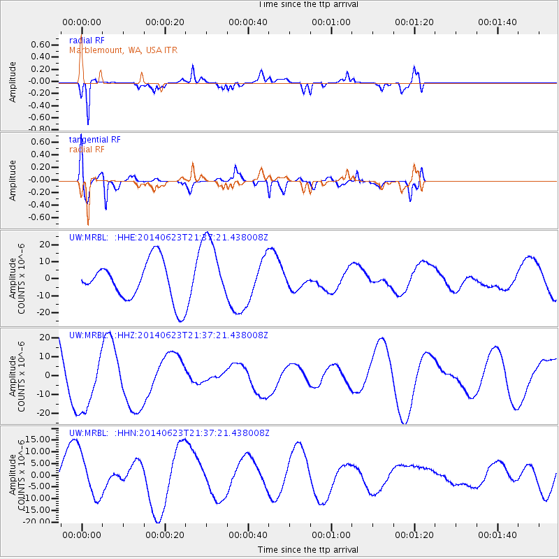
MRBL Marblemount, WA, USA - Earthquake Result Viewer
*The percent match for this event was below the threshold and hence no stack was calculated.
| Earthquake location: |
Rat Islands, Aleutian Islands |
| Earthquake latitude/longitude: |
52.0/178.4 |
| Earthquake time(UTC): |
2014/06/23 (174) 21:30:47 GMT |
| Earthquake Depth: |
109 km |
| Earthquake Magnitude: |
5.9 MB |
| Earthquake Catalog/Contributor: |
NEIC PDE/NEIC COMCAT |
|
| Network: |
UW Pacific Northwest Regional Seismic Network |
| Station: |
MRBL Marblemount, WA, USA |
| Lat/Lon: |
48.52 N/121.48 W |
| Elevation: |
75 m |
|
| Distance: |
37.7 deg |
| Az: |
70.714 deg |
| Baz: |
298.629 deg |
| Ray Param: |
$rayparam |
*The percent match for this event was below the threshold and hence was not used in the summary stack. |
|
| Radial Match: |
67.3886 % |
| Radial Bump: |
296 |
| Transverse Match: |
58.339447 % |
| Transverse Bump: |
400 |
| SOD ConfigId: |
739768 |
| Insert Time: |
2014-07-07 23:22:21.995 +0000 |
| GWidth: |
2.5 |
| Max Bumps: |
400 |
| Tol: |
0.001 |
|
Signal To Noise
| Channel | StoN | STA | LTA |
| UW:MRBL: :HHZ:20140623T21:37:21.438008Z | 1.1666187 | 1.6081642E-5 | 1.378483E-5 |
| UW:MRBL: :HHN:20140623T21:37:21.438008Z | 2.4548168 | 9.117151E-6 | 3.7139844E-6 |
| UW:MRBL: :HHE:20140623T21:37:21.438008Z | 1.7172089 | 1.9830843E-5 | 1.15483E-5 |
| Arrivals |
| Ps | |
| PpPs | |
| PsPs/PpSs | |


