You are here: Home > Network List > II - Global Seismograph Network (GSN - IRIS/IDA) Stations List
> Station WRAB Tennant Creek, NT, Australia > Earthquake Result Viewer
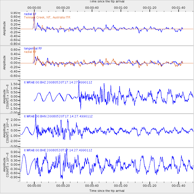
WRAB Tennant Creek, NT, Australia - Earthquake Result Viewer
*The percent match for this event was below the threshold and hence no stack was calculated.
| Earthquake location: |
Southern Sumatra, Indonesia |
| Earthquake latitude/longitude: |
-3.2/101.5 |
| Earthquake time(UTC): |
2008/05/20 (141) 17:08:00 GMT |
| Earthquake Depth: |
48 km |
| Earthquake Magnitude: |
5.6 MB, 5.2 MS, 5.7 MW, 5.6 MW |
| Earthquake Catalog/Contributor: |
WHDF/NEIC |
|
| Network: |
II Global Seismograph Network (GSN - IRIS/IDA) |
| Station: |
WRAB Tennant Creek, NT, Australia |
| Lat/Lon: |
19.93 S/134.36 E |
| Elevation: |
366 m |
|
| Distance: |
36.1 deg |
| Az: |
119.994 deg |
| Baz: |
293.196 deg |
| Ray Param: |
$rayparam |
*The percent match for this event was below the threshold and hence was not used in the summary stack. |
|
| Radial Match: |
66.451195 % |
| Radial Bump: |
400 |
| Transverse Match: |
80.04543 % |
| Transverse Bump: |
400 |
| SOD ConfigId: |
2504 |
| Insert Time: |
2010-03-01 23:28:00.119 +0000 |
| GWidth: |
2.5 |
| Max Bumps: |
400 |
| Tol: |
0.001 |
|
Signal To Noise
| Channel | StoN | STA | LTA |
| II:WRAB:00:BHN:20080520T17:14:27.499011Z | 2.0691683 | 9.105582E-7 | 4.4005998E-7 |
| II:WRAB:00:BHE:20080520T17:14:27.499011Z | 0.9980873 | 4.1723885E-7 | 4.1803844E-7 |
| II:WRAB:00:BHZ:20080520T17:14:27.499011Z | 1.7036719 | 5.916568E-7 | 3.472833E-7 |
| Arrivals |
| Ps | |
| PpPs | |
| PsPs/PpSs | |


