You are here: Home > Network List > TA - USArray Transportable Network (new EarthScope stations) Stations List
> Station R11A Troy Canyon, Currant, NV, USA > Earthquake Result Viewer
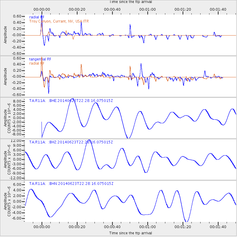
R11A Troy Canyon, Currant, NV, USA - Earthquake Result Viewer
*The percent match for this event was below the threshold and hence no stack was calculated.
| Earthquake location: |
Kermadec Islands, New Zealand |
| Earthquake latitude/longitude: |
-30.2/-177.8 |
| Earthquake time(UTC): |
2014/06/23 (174) 22:15:50 GMT |
| Earthquake Depth: |
10 km |
| Earthquake Magnitude: |
5.5 MB |
| Earthquake Catalog/Contributor: |
NEIC PDE/NEIC COMCAT |
|
| Network: |
TA USArray Transportable Network (new EarthScope stations) |
| Station: |
R11A Troy Canyon, Currant, NV, USA |
| Lat/Lon: |
38.35 N/115.59 W |
| Elevation: |
1756 m |
|
| Distance: |
89.5 deg |
| Az: |
44.064 deg |
| Baz: |
229.982 deg |
| Ray Param: |
$rayparam |
*The percent match for this event was below the threshold and hence was not used in the summary stack. |
|
| Radial Match: |
64.33145 % |
| Radial Bump: |
400 |
| Transverse Match: |
52.818226 % |
| Transverse Bump: |
400 |
| SOD ConfigId: |
739768 |
| Insert Time: |
2014-07-07 23:40:11.666 +0000 |
| GWidth: |
2.5 |
| Max Bumps: |
400 |
| Tol: |
0.001 |
|
Signal To Noise
| Channel | StoN | STA | LTA |
| TA:R11A: :BHZ:20140623T22:28:16.075015Z | 0.63892585 | 2.0440307E-6 | 3.1991672E-6 |
| TA:R11A: :BHN:20140623T22:28:16.075015Z | 0.8550898 | 3.4141678E-6 | 3.9927595E-6 |
| TA:R11A: :BHE:20140623T22:28:16.075015Z | 1.3004738 | 6.6222374E-6 | 5.092173E-6 |
| Arrivals |
| Ps | |
| PpPs | |
| PsPs/PpSs | |


