You are here: Home > Network List > II - Global Seismograph Network (GSN - IRIS/IDA) Stations List
> Station WRAB Tennant Creek, NT, Australia > Earthquake Result Viewer
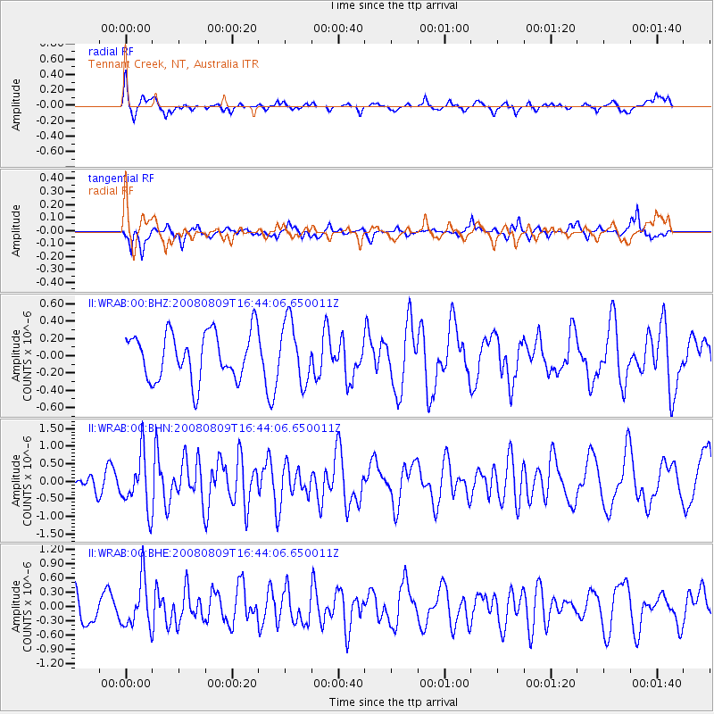
WRAB Tennant Creek, NT, Australia - Earthquake Result Viewer
*The percent match for this event was below the threshold and hence no stack was calculated.
| Earthquake location: |
West Of Macquarie Island |
| Earthquake latitude/longitude: |
-60.7/153.8 |
| Earthquake time(UTC): |
2008/08/09 (222) 16:36:38 GMT |
| Earthquake Depth: |
10 km |
| Earthquake Magnitude: |
5.7 MB, 6.0 MS, 6.3 MW, 6.3 MW |
| Earthquake Catalog/Contributor: |
WHDF/NEIC |
|
| Network: |
II Global Seismograph Network (GSN - IRIS/IDA) |
| Station: |
WRAB Tennant Creek, NT, Australia |
| Lat/Lon: |
19.93 S/134.36 E |
| Elevation: |
366 m |
|
| Distance: |
43.0 deg |
| Az: |
332.626 deg |
| Baz: |
166.087 deg |
| Ray Param: |
$rayparam |
*The percent match for this event was below the threshold and hence was not used in the summary stack. |
|
| Radial Match: |
73.26769 % |
| Radial Bump: |
400 |
| Transverse Match: |
68.52573 % |
| Transverse Bump: |
400 |
| SOD ConfigId: |
2504 |
| Insert Time: |
2010-03-01 23:28:27.242 +0000 |
| GWidth: |
2.5 |
| Max Bumps: |
400 |
| Tol: |
0.001 |
|
Signal To Noise
| Channel | StoN | STA | LTA |
| II:WRAB:00:BHN:20080809T16:44:06.650011Z | 3.9329083 | 7.814045E-7 | 1.9868364E-7 |
| II:WRAB:00:BHE:20080809T16:44:06.650011Z | 2.294327 | 5.100171E-7 | 2.2229487E-7 |
| II:WRAB:00:BHZ:20080809T16:44:06.650011Z | 1.3024899 | 3.5434655E-7 | 2.720532E-7 |
| Arrivals |
| Ps | |
| PpPs | |
| PsPs/PpSs | |


