You are here: Home > Network List > II - Global Seismograph Network (GSN - IRIS/IDA) Stations List
> Station WRAB Tennant Creek, NT, Australia > Earthquake Result Viewer
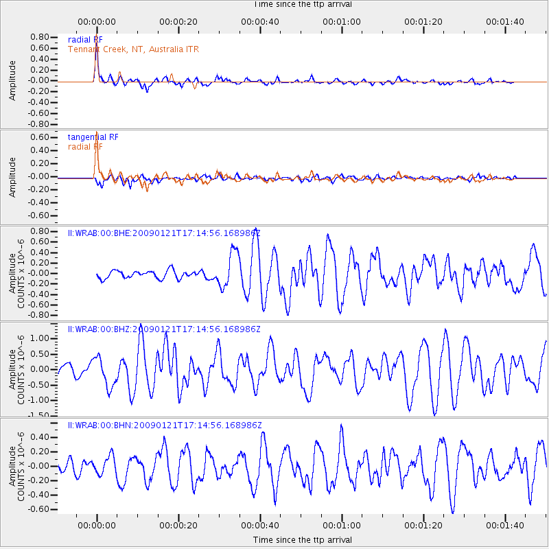
WRAB Tennant Creek, NT, Australia - Earthquake Result Viewer
*The percent match for this event was below the threshold and hence no stack was calculated.
| Earthquake location: |
Southeast Of Loyalty Islands |
| Earthquake latitude/longitude: |
-22.7/171.0 |
| Earthquake time(UTC): |
2009/01/21 (021) 17:08:42 GMT |
| Earthquake Depth: |
24 km |
| Earthquake Magnitude: |
5.8 MS, 5.4 MB, 6.1 MW, 6.1 MW |
| Earthquake Catalog/Contributor: |
WHDF/NEIC |
|
| Network: |
II Global Seismograph Network (GSN - IRIS/IDA) |
| Station: |
WRAB Tennant Creek, NT, Australia |
| Lat/Lon: |
19.93 S/134.36 E |
| Elevation: |
366 m |
|
| Distance: |
34.2 deg |
| Az: |
267.593 deg |
| Baz: |
101.258 deg |
| Ray Param: |
$rayparam |
*The percent match for this event was below the threshold and hence was not used in the summary stack. |
|
| Radial Match: |
78.17789 % |
| Radial Bump: |
333 |
| Transverse Match: |
68.57561 % |
| Transverse Bump: |
400 |
| SOD ConfigId: |
2834 |
| Insert Time: |
2010-03-01 23:28:35.686 +0000 |
| GWidth: |
2.5 |
| Max Bumps: |
400 |
| Tol: |
0.001 |
|
Signal To Noise
| Channel | StoN | STA | LTA |
| II:WRAB:00:BHZ:20090121T17:14:56.168986Z | 2.4803383 | 4.842479E-7 | 1.952346E-7 |
| II:WRAB:00:BHN:20090121T17:14:56.168986Z | 0.7923931 | 1.2643264E-7 | 1.5955798E-7 |
| II:WRAB:00:BHE:20090121T17:14:56.168986Z | 4.6754403 | 3.4245835E-7 | 7.324622E-8 |
| Arrivals |
| Ps | |
| PpPs | |
| PsPs/PpSs | |


