You are here: Home > Network List > II - Global Seismograph Network (GSN - IRIS/IDA) Stations List
> Station WRAB Tennant Creek, NT, Australia > Earthquake Result Viewer
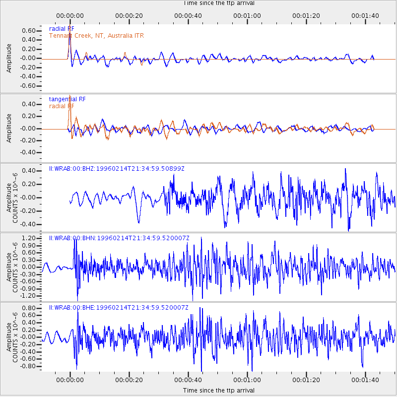
WRAB Tennant Creek, NT, Australia - Earthquake Result Viewer
*The percent match for this event was below the threshold and hence no stack was calculated.
| Earthquake location: |
Southeast Of Honshu, Japan |
| Earthquake latitude/longitude: |
29.2/140.4 |
| Earthquake time(UTC): |
1996/02/14 (045) 21:26:56 GMT |
| Earthquake Depth: |
142 km |
| Earthquake Magnitude: |
5.9 MB |
| Earthquake Catalog/Contributor: |
WHDF/NEIC |
|
| Network: |
II Global Seismograph Network (GSN - IRIS/IDA) |
| Station: |
WRAB Tennant Creek, NT, Australia |
| Lat/Lon: |
19.93 S/134.36 E |
| Elevation: |
366 m |
|
| Distance: |
49.2 deg |
| Az: |
187.492 deg |
| Baz: |
6.958 deg |
| Ray Param: |
$rayparam |
*The percent match for this event was below the threshold and hence was not used in the summary stack. |
|
| Radial Match: |
59.360203 % |
| Radial Bump: |
400 |
| Transverse Match: |
46.0459 % |
| Transverse Bump: |
400 |
| SOD ConfigId: |
4480 |
| Insert Time: |
2010-03-01 23:28:38.094 +0000 |
| GWidth: |
2.5 |
| Max Bumps: |
400 |
| Tol: |
0.001 |
|
Signal To Noise
| Channel | StoN | STA | LTA |
| II:WRAB:00:BHN:19960214T21:34:59.520007Z | 2.798884 | 4.7919224E-7 | 1.7120833E-7 |
| II:WRAB:00:BHE:19960214T21:34:59.520007Z | 2.5362566 | 2.9568318E-7 | 1.1658252E-7 |
| II:WRAB:00:BHZ:19960214T21:34:59.50899Z | 1.2148718 | 1.14175315E-7 | 9.398138E-8 |
| Arrivals |
| Ps | |
| PpPs | |
| PsPs/PpSs | |


