You are here: Home > Network List > TA - USArray Transportable Network (new EarthScope stations) Stations List
> Station 109C Camp Elliot, Mirimar, CA, USA > Earthquake Result Viewer
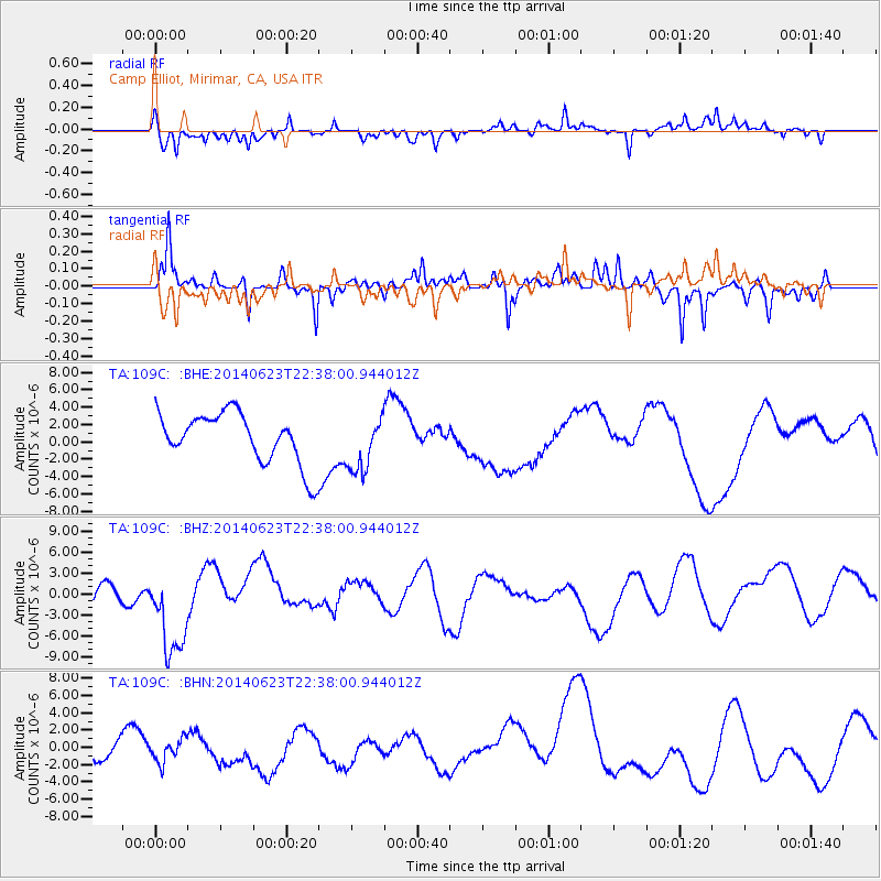
109C Camp Elliot, Mirimar, CA, USA - Earthquake Result Viewer
*The percent match for this event was below the threshold and hence no stack was calculated.
| Earthquake location: |
Rat Islands, Aleutian Islands |
| Earthquake latitude/longitude: |
52.0/178.6 |
| Earthquake time(UTC): |
2014/06/23 (174) 22:29:51 GMT |
| Earthquake Depth: |
103 km |
| Earthquake Magnitude: |
5.9 MB |
| Earthquake Catalog/Contributor: |
NEIC PDE/NEIC COMCAT |
|
| Network: |
TA USArray Transportable Network (new EarthScope stations) |
| Station: |
109C Camp Elliot, Mirimar, CA, USA |
| Lat/Lon: |
32.89 N/117.11 W |
| Elevation: |
150 m |
|
| Distance: |
49.5 deg |
| Az: |
86.366 deg |
| Baz: |
312.778 deg |
| Ray Param: |
$rayparam |
*The percent match for this event was below the threshold and hence was not used in the summary stack. |
|
| Radial Match: |
68.58805 % |
| Radial Bump: |
357 |
| Transverse Match: |
70.58431 % |
| Transverse Bump: |
394 |
| SOD ConfigId: |
739768 |
| Insert Time: |
2014-07-08 00:30:29.764 +0000 |
| GWidth: |
2.5 |
| Max Bumps: |
400 |
| Tol: |
0.001 |
|
Signal To Noise
| Channel | StoN | STA | LTA |
| TA:109C: :BHZ:20140623T22:38:00.944012Z | 1.5479931 | 6.4347137E-6 | 4.1568105E-6 |
| TA:109C: :BHN:20140623T22:38:00.944012Z | 1.3187323 | 1.5008618E-6 | 1.1381096E-6 |
| TA:109C: :BHE:20140623T22:38:00.944012Z | 1.0977211 | 3.1727227E-6 | 2.8902812E-6 |
| Arrivals |
| Ps | |
| PpPs | |
| PsPs/PpSs | |


