You are here: Home > Network List > II - Global Seismograph Network (GSN - IRIS/IDA) Stations List
> Station WRAB Tennant Creek, NT, Australia > Earthquake Result Viewer
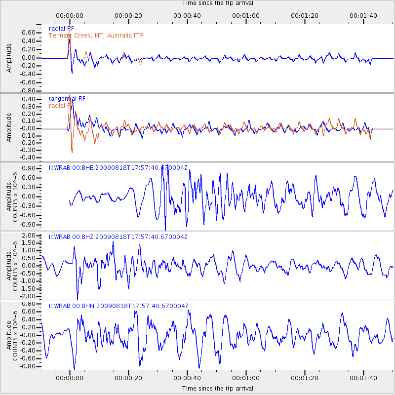
WRAB Tennant Creek, NT, Australia - Earthquake Result Viewer
*The percent match for this event was below the threshold and hence no stack was calculated.
| Earthquake location: |
Southwest Of Sumatra, Indonesia |
| Earthquake latitude/longitude: |
-0.9/97.9 |
| Earthquake time(UTC): |
2009/08/18 (230) 17:50:34 GMT |
| Earthquake Depth: |
10 km |
| Earthquake Magnitude: |
5.5 MB, 5.5 MS, 5.9 MW |
| Earthquake Catalog/Contributor: |
WHDF/NEIC |
|
| Network: |
II Global Seismograph Network (GSN - IRIS/IDA) |
| Station: |
WRAB Tennant Creek, NT, Australia |
| Lat/Lon: |
19.93 S/134.36 E |
| Elevation: |
366 m |
|
| Distance: |
40.3 deg |
| Az: |
120.345 deg |
| Baz: |
293.484 deg |
| Ray Param: |
$rayparam |
*The percent match for this event was below the threshold and hence was not used in the summary stack. |
|
| Radial Match: |
63.225697 % |
| Radial Bump: |
400 |
| Transverse Match: |
63.8021 % |
| Transverse Bump: |
400 |
| SOD ConfigId: |
2622 |
| Insert Time: |
2010-03-01 23:29:05.088 +0000 |
| GWidth: |
2.5 |
| Max Bumps: |
400 |
| Tol: |
0.001 |
|
Signal To Noise
| Channel | StoN | STA | LTA |
| II:WRAB:00:BHZ:20090818T17:57:40.670004Z | 2.0714583 | 7.6630596E-7 | 3.6993546E-7 |
| II:WRAB:00:BHN:20090818T17:57:40.670004Z | 1.262604 | 3.987779E-7 | 3.1583767E-7 |
| II:WRAB:00:BHE:20090818T17:57:40.670004Z | 3.270681 | 5.9203046E-7 | 1.8101139E-7 |
| Arrivals |
| Ps | |
| PpPs | |
| PsPs/PpSs | |


