You are here: Home > Network List > GS - US Geological Survey Networks Stations List
> Station KAN10 Keim Farm > Earthquake Result Viewer
KAN10 Keim Farm - Earthquake Result Viewer
*The percent match for this event was below the threshold and hence no stack was calculated.
| Earthquake location: |
Fiji Islands Region |
| Earthquake latitude/longitude: |
-17.9/-178.4 |
| Earthquake time(UTC): |
2015/03/22 (081) 05:46:22 GMT |
| Earthquake Depth: |
616 km |
| Earthquake Magnitude: |
6.1 MW, 5.3 mb |
| Earthquake Catalog/Contributor: |
ISC/ISC |
|
| Network: |
GS US Geological Survey Networks |
| Station: |
KAN10 Keim Farm |
| Lat/Lon: |
37.12 N/98.10 W |
| Elevation: |
417 m |
|
| Distance: |
93.2 deg |
| Az: |
52.098 deg |
| Baz: |
250.043 deg |
| Ray Param: |
$rayparam |
*The percent match for this event was below the threshold and hence was not used in the summary stack. |
|
| Radial Match: |
39.66458 % |
| Radial Bump: |
400 |
| Transverse Match: |
41.00685 % |
| Transverse Bump: |
400 |
| SOD ConfigId: |
7422571 |
| Insert Time: |
2019-04-17 21:02:19.823 +0000 |
| GWidth: |
2.5 |
| Max Bumps: |
400 |
| Tol: |
0.001 |
|
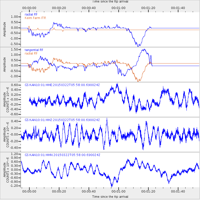
Signal To Noise
| Channel | StoN | STA | LTA |
| GS:KAN10:01:HHZ:20150322T05:58:00.690024Z | 0.63854283 | 1.0250919E-7 | 1.6053613E-7 |
| GS:KAN10:01:HHN:20150322T05:58:00.690024Z | 0.3553797 | 1.2948617E-7 | 3.643601E-7 |
| GS:KAN10:01:HHE:20150322T05:58:00.690024Z | 1.4123021 | 1.4585895E-7 | 1.03277436E-7 |
| Arrivals |
| Ps | |
| PpPs | |
| PsPs/PpSs | |


