You are here: Home > Network List > II - Global Seismograph Network (GSN - IRIS/IDA) Stations List
> Station WRAB Tennant Creek, NT, Australia > Earthquake Result Viewer
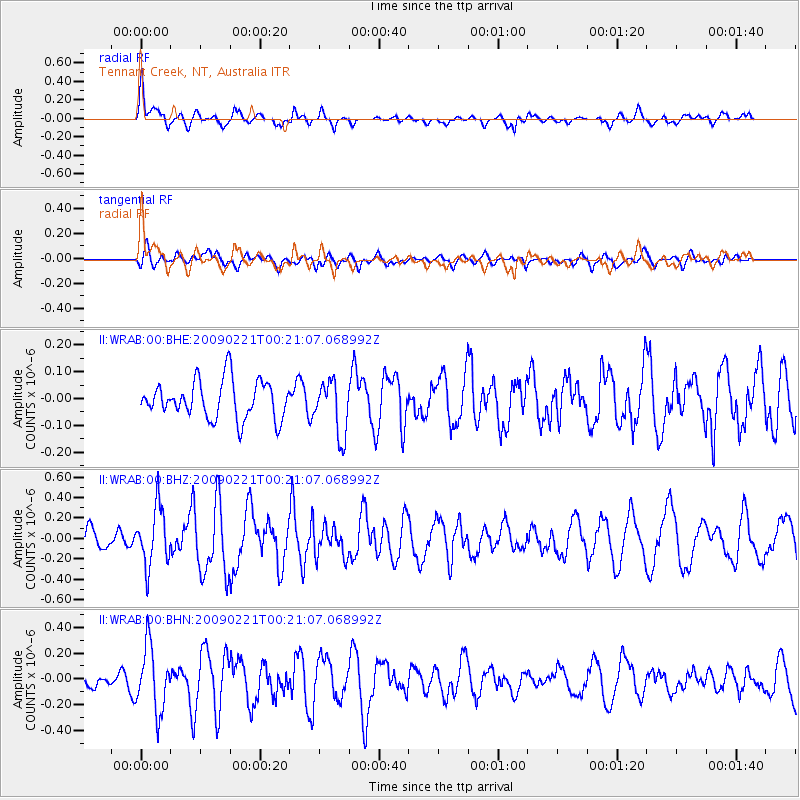
WRAB Tennant Creek, NT, Australia - Earthquake Result Viewer
*The percent match for this event was below the threshold and hence no stack was calculated.
| Earthquake location: |
Ryukyu Islands, Japan |
| Earthquake latitude/longitude: |
28.9/130.9 |
| Earthquake time(UTC): |
2009/02/21 (052) 00:12:56 GMT |
| Earthquake Depth: |
24 km |
| Earthquake Magnitude: |
5.6 MB, 5.0 MS, 5.5 MW, 5.5 MW |
| Earthquake Catalog/Contributor: |
WHDF/NEIC |
|
| Network: |
II Global Seismograph Network (GSN - IRIS/IDA) |
| Station: |
WRAB Tennant Creek, NT, Australia |
| Lat/Lon: |
19.93 S/134.36 E |
| Elevation: |
366 m |
|
| Distance: |
48.6 deg |
| Az: |
175.616 deg |
| Baz: |
355.914 deg |
| Ray Param: |
$rayparam |
*The percent match for this event was below the threshold and hence was not used in the summary stack. |
|
| Radial Match: |
58.58965 % |
| Radial Bump: |
400 |
| Transverse Match: |
51.18019 % |
| Transverse Bump: |
400 |
| SOD ConfigId: |
2658 |
| Insert Time: |
2010-03-01 23:29:29.545 +0000 |
| GWidth: |
2.5 |
| Max Bumps: |
400 |
| Tol: |
0.001 |
|
Signal To Noise
| Channel | StoN | STA | LTA |
| II:WRAB:00:BHZ:20090221T00:21:07.068992Z | 2.5563643 | 2.8549263E-7 | 1.1167917E-7 |
| II:WRAB:00:BHN:20090221T00:21:07.068992Z | 3.4559727 | 2.5092055E-7 | 7.2604905E-8 |
| II:WRAB:00:BHE:20090221T00:21:07.068992Z | 1.4333053 | 1.01237816E-7 | 7.063242E-8 |
| Arrivals |
| Ps | |
| PpPs | |
| PsPs/PpSs | |


