You are here: Home > Network List > II - Global Seismograph Network (GSN - IRIS/IDA) Stations List
> Station WRAB Tennant Creek, NT, Australia > Earthquake Result Viewer
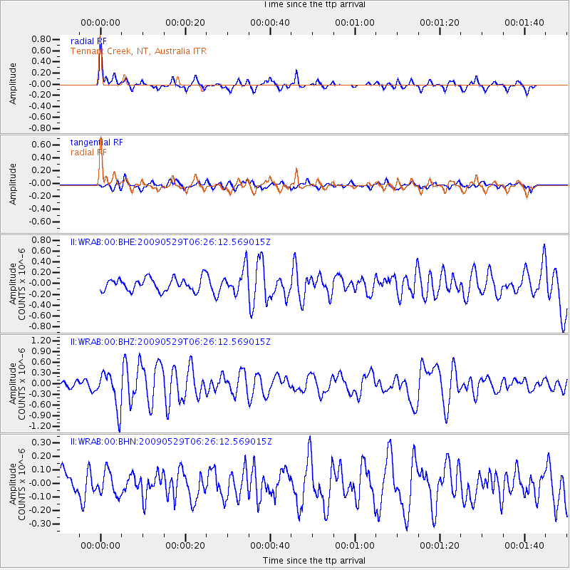
WRAB Tennant Creek, NT, Australia - Earthquake Result Viewer
*The percent match for this event was below the threshold and hence no stack was calculated.
| Earthquake location: |
Vanuatu Islands |
| Earthquake latitude/longitude: |
-17.0/168.3 |
| Earthquake time(UTC): |
2009/05/29 (149) 06:20:14 GMT |
| Earthquake Depth: |
13 km |
| Earthquake Magnitude: |
5.5 MB, 5.5 MS, 5.7 MW, 5.6 MW |
| Earthquake Catalog/Contributor: |
WHDF/NEIC |
|
| Network: |
II Global Seismograph Network (GSN - IRIS/IDA) |
| Station: |
WRAB Tennant Creek, NT, Australia |
| Lat/Lon: |
19.93 S/134.36 E |
| Elevation: |
366 m |
|
| Distance: |
32.3 deg |
| Az: |
259.526 deg |
| Baz: |
90.523 deg |
| Ray Param: |
$rayparam |
*The percent match for this event was below the threshold and hence was not used in the summary stack. |
|
| Radial Match: |
77.20302 % |
| Radial Bump: |
381 |
| Transverse Match: |
75.401924 % |
| Transverse Bump: |
400 |
| SOD ConfigId: |
2648 |
| Insert Time: |
2010-03-01 23:29:30.839 +0000 |
| GWidth: |
2.5 |
| Max Bumps: |
400 |
| Tol: |
0.001 |
|
Signal To Noise
| Channel | StoN | STA | LTA |
| II:WRAB:00:BHZ:20090529T06:26:12.569015Z | 4.504512 | 5.25882E-7 | 1.1674561E-7 |
| II:WRAB:00:BHN:20090529T06:26:12.569015Z | 0.99029624 | 8.7813206E-8 | 8.867367E-8 |
| II:WRAB:00:BHE:20090529T06:26:12.569015Z | 1.9939381 | 2.3291145E-7 | 1.16809765E-7 |
| Arrivals |
| Ps | |
| PpPs | |
| PsPs/PpSs | |


