You are here: Home > Network List > II - Global Seismograph Network (GSN - IRIS/IDA) Stations List
> Station WRAB Tennant Creek, NT, Australia > Earthquake Result Viewer
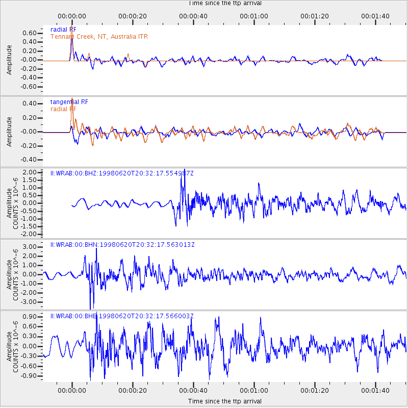
WRAB Tennant Creek, NT, Australia - Earthquake Result Viewer
*The percent match for this event was below the threshold and hence no stack was calculated.
| Earthquake location: |
Kermadec Islands, New Zealand |
| Earthquake latitude/longitude: |
-30.1/-177.9 |
| Earthquake time(UTC): |
1998/06/20 (171) 20:24:45 GMT |
| Earthquake Depth: |
57 km |
| Earthquake Magnitude: |
5.7 MB, 6.0 UNKNOWN, 6.0 MW |
| Earthquake Catalog/Contributor: |
WHDF/NEIC |
|
| Network: |
II Global Seismograph Network (GSN - IRIS/IDA) |
| Station: |
WRAB Tennant Creek, NT, Australia |
| Lat/Lon: |
19.93 S/134.36 E |
| Elevation: |
366 m |
|
| Distance: |
44.1 deg |
| Az: |
271.829 deg |
| Baz: |
112.985 deg |
| Ray Param: |
$rayparam |
*The percent match for this event was below the threshold and hence was not used in the summary stack. |
|
| Radial Match: |
78.62414 % |
| Radial Bump: |
400 |
| Transverse Match: |
63.593098 % |
| Transverse Bump: |
400 |
| SOD ConfigId: |
4480 |
| Insert Time: |
2010-03-01 23:29:36.509 +0000 |
| GWidth: |
2.5 |
| Max Bumps: |
400 |
| Tol: |
0.001 |
|
Signal To Noise
| Channel | StoN | STA | LTA |
| II:WRAB:00:BHN:19980620T20:32:17.563013Z | 1.7910947 | 6.544017E-7 | 3.653641E-7 |
| II:WRAB:00:BHE:19980620T20:32:17.566003Z | 0.77011883 | 2.0738806E-7 | 2.6929357E-7 |
| II:WRAB:00:BHZ:19980620T20:32:17.554987Z | 2.7988276 | 4.3587147E-7 | 1.557336E-7 |
| Arrivals |
| Ps | |
| PpPs | |
| PsPs/PpSs | |


