You are here: Home > Network List > II - Global Seismograph Network (GSN - IRIS/IDA) Stations List
> Station WRAB Tennant Creek, NT, Australia > Earthquake Result Viewer
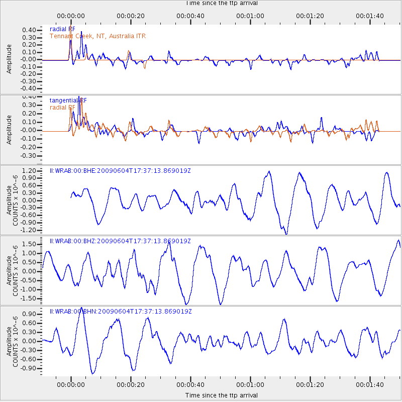
WRAB Tennant Creek, NT, Australia - Earthquake Result Viewer
*The percent match for this event was below the threshold and hence no stack was calculated.
| Earthquake location: |
Prince Edward Islands Region |
| Earthquake latitude/longitude: |
-45.8/35.1 |
| Earthquake time(UTC): |
2009/06/04 (155) 17:25:25 GMT |
| Earthquake Depth: |
16 km |
| Earthquake Magnitude: |
5.5 MB, 5.7 MS, 6.0 MW, 6.0 MW |
| Earthquake Catalog/Contributor: |
WHDF/NEIC |
|
| Network: |
II Global Seismograph Network (GSN - IRIS/IDA) |
| Station: |
WRAB Tennant Creek, NT, Australia |
| Lat/Lon: |
19.93 S/134.36 E |
| Elevation: |
366 m |
|
| Distance: |
82.1 deg |
| Az: |
110.366 deg |
| Baz: |
224.161 deg |
| Ray Param: |
$rayparam |
*The percent match for this event was below the threshold and hence was not used in the summary stack. |
|
| Radial Match: |
65.60051 % |
| Radial Bump: |
400 |
| Transverse Match: |
76.682816 % |
| Transverse Bump: |
400 |
| SOD ConfigId: |
2648 |
| Insert Time: |
2010-03-01 23:29:41.002 +0000 |
| GWidth: |
2.5 |
| Max Bumps: |
400 |
| Tol: |
0.001 |
|
Signal To Noise
| Channel | StoN | STA | LTA |
| II:WRAB:00:BHZ:20090604T17:37:13.869019Z | 0.74916416 | 5.2805456E-7 | 7.048583E-7 |
| II:WRAB:00:BHN:20090604T17:37:13.869019Z | 2.2722914 | 6.673079E-7 | 2.936718E-7 |
| II:WRAB:00:BHE:20090604T17:37:13.869019Z | 0.6181553 | 2.5141424E-7 | 4.0671694E-7 |
| Arrivals |
| Ps | |
| PpPs | |
| PsPs/PpSs | |


